QGIS-Based Solutions
Fast, transparent, and agile development from start to finish.
Open-Source Technology for Advanced Spatial Workflows
Forestry is one of the most data-intensive sectors, which makes QGIS the most practical, scalable, and cost-effective way to support your business processes. Arbonaut develops QGIS-based geospatial solutions for data creation, editing, analysis, and reporting, ensuring a reliable setup that you can trust in your daily operations.
User-friendly tailored tools your team will actually use
From small modules to full-scale systems
Over 30,000 companies use QGIS worldwide
For forestry, environmental services, and other industries
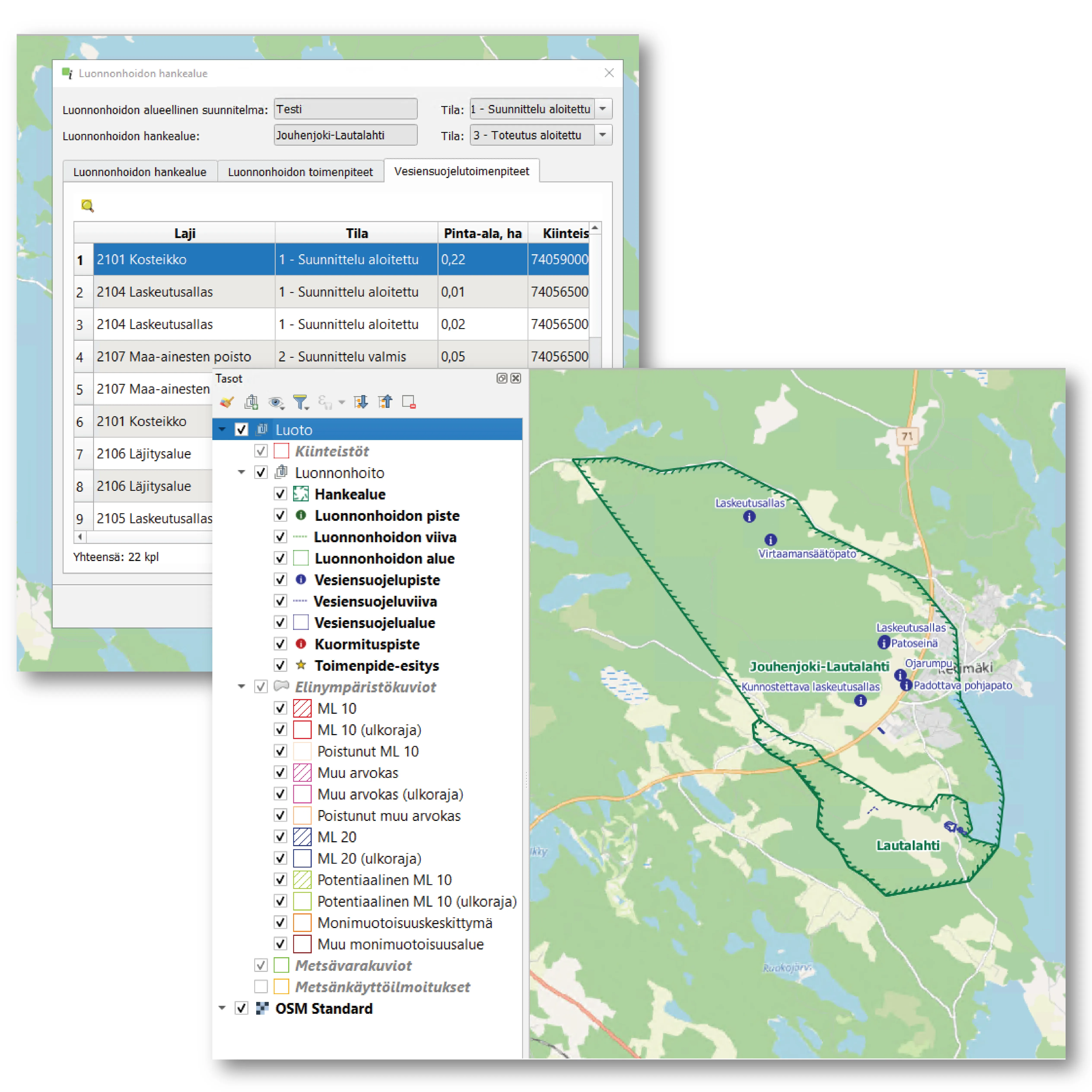
Data browsing and editing
- Customized windows for data entry
- Validation rules to improve data quality and avoid future data-entry errors
- Tailored spatial editing tools and styling for map objects
- System integration with a mobile app for field data collection
- Access control based on user roles to limit editing rights and tool access
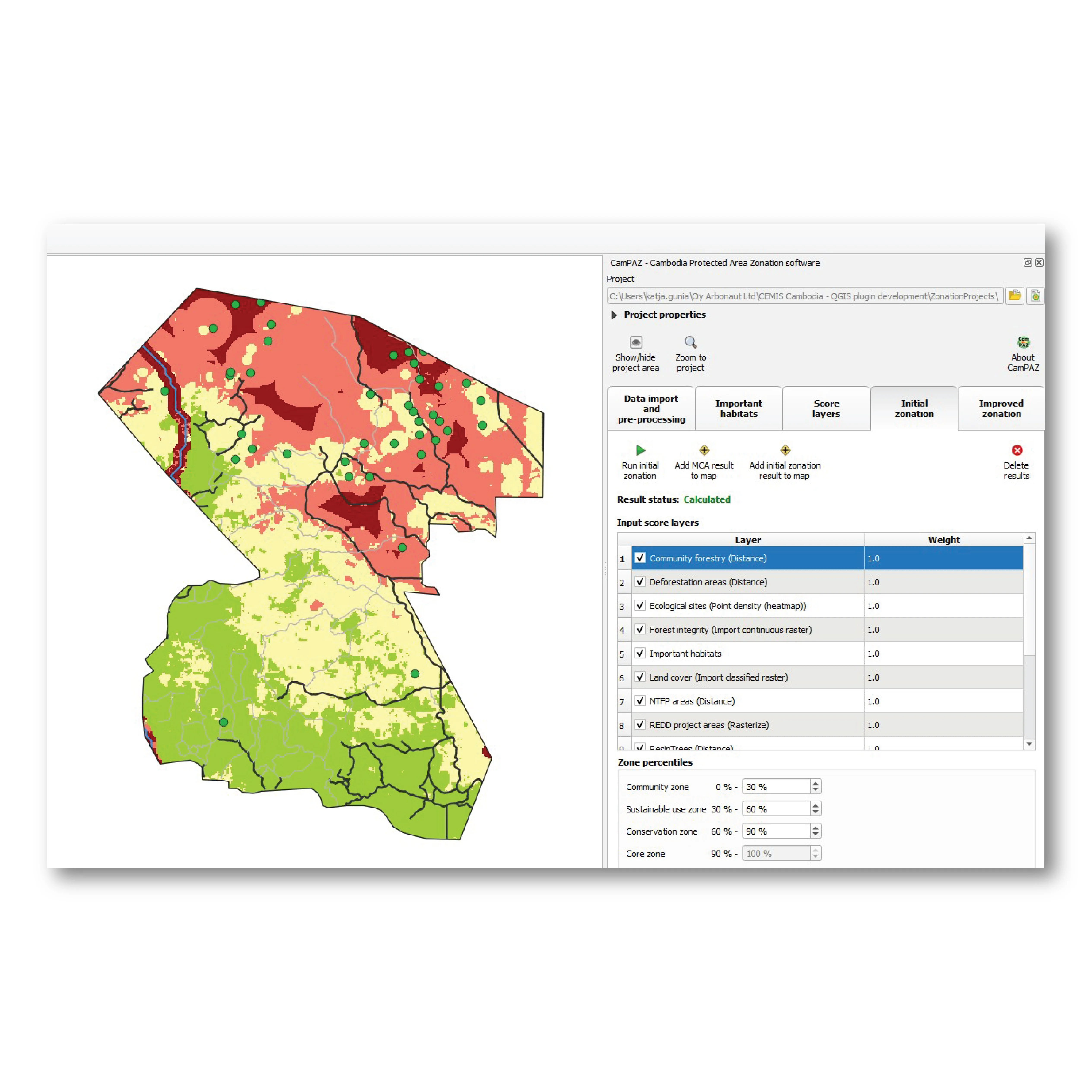
Data analysis
- Tailored data analysis processes and toolsets for calculating the needed metrics from existing data
- Visualization of analysis results on the map and via reports
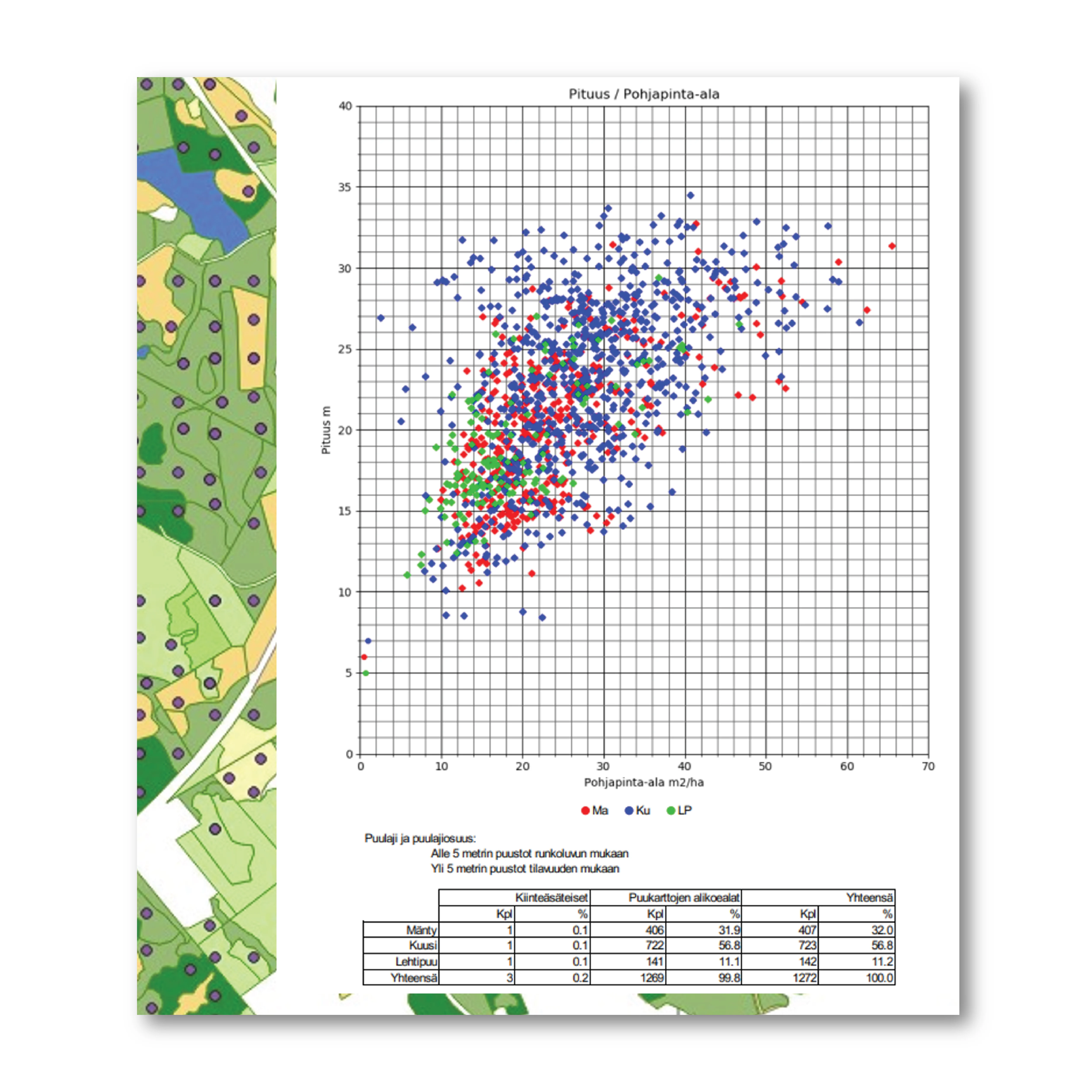
Reports
- Designed summary tables
- Development of visualization of your data’s overall view
- Custom tables to view your reports
What to Expect from Our QGIS Development
-
1. Understanding your processes
We map how your team works and design the system to support your processes in the best possible way.
-
2. Co-creating the specifications
Together we define the system specifications, ensuring full alignment from the start.
-
3. Transparent estimates
Clear project duration and pricing based on agreed scope.
-
4. Agile development with weekly reviews
As our team starts building the solution, we check-in weekly to review progress, allowing Arbonaut to refine features continuously.
-
5. Internal testing
Each development step is tested for performance and stability before you see it.
-
6. Customer review of new versions
You test and validate each version, giving us feedback for the next iteration.
-
7. Final deployment
We deliver the system to your server or cloud environment and ensure your team can use the solution with confidence via capacity-building sessions.
-
8. Maintenance and upkeep
After delivery, we stay with you. We offer continuous maintenance, updates, and troubleshooting to keep your system running at its best.
Is It Time to Upgrade Your GIS Infrastructure?
From architecture to deployment, our QGIS-based systems deliver value from day one.
Frequently Asked Questions
 Cookie Policy