Decision-Support for Daily Forest Management
Get clarity across every hectare you own.
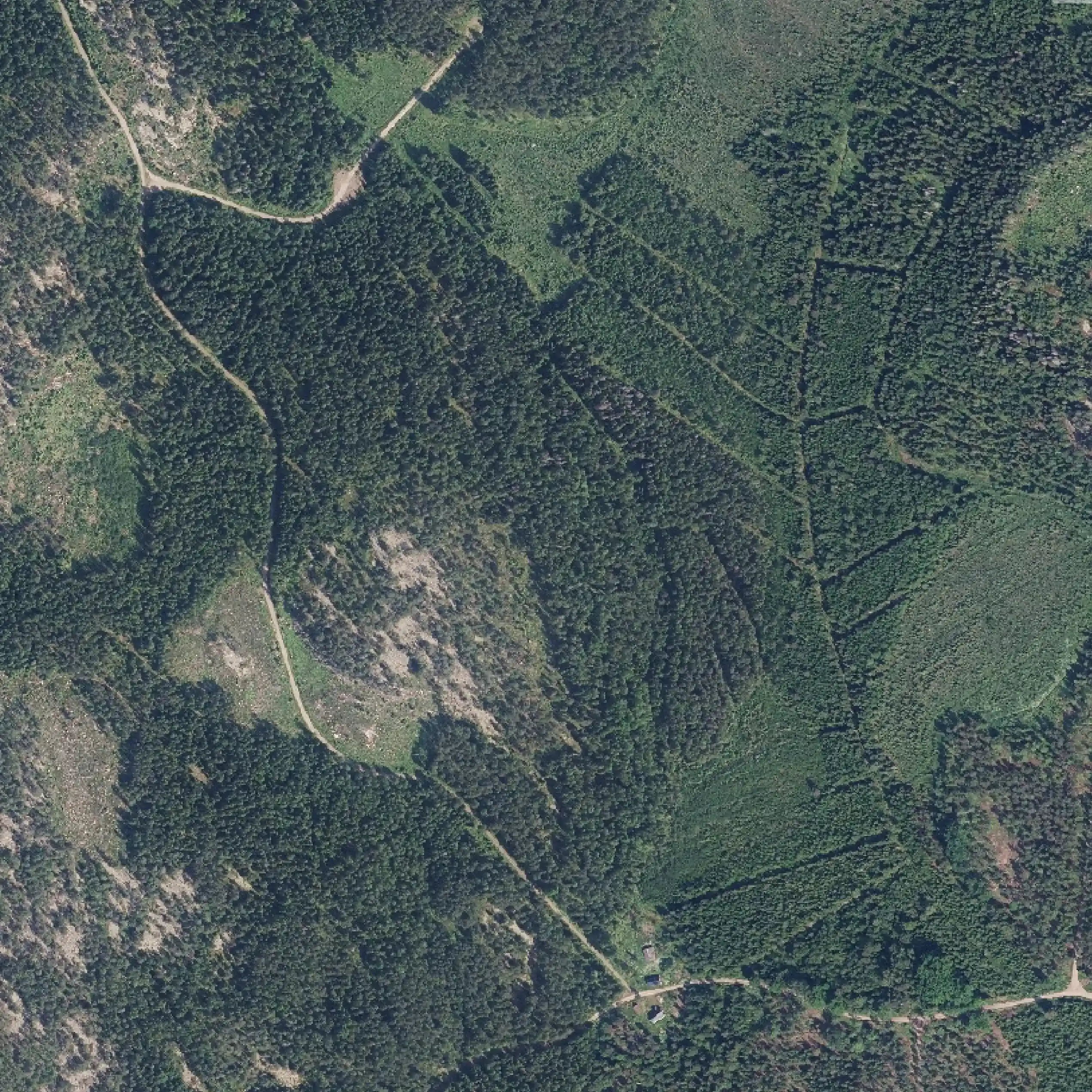
See Your Forest as It Truly Is
You are responsible for forests that must stay productive, profitable, and protected, all at the same time. Some days you're solving operational challenges; other days you're navigating decisions that shape your forest for decades. You know every forest stand is different, and you need tools and insights that help you manage it all with confidence.
Precise, up‑to‑date view of your entire forest with less fieldwork
Adapt to shifting timber markets 20x faster, long before they impact your bottom line
Replace manual checks with remote sensing and free your time for operational progress
Stay ahead of shifting conditions, planning windows, and environmental risks
Pain point
Up to 90% of planning time is wasted in the field
Field-based data collection only leaves 10% of time for actual planning and decision-making. The result: limited coverage, higher costs, and persistent bottlenecks across your entire operation.
Arbonaut's solution
Achieve 20x planning efficiency with LiDAR
Instead of walking the forest, our datasets can boost your performance with ready-to-use intelligence. Instead of inspecting 20-50 stands per day, you can analyze 1,000 hectares from your desk with no loss of accuracy.
Pain point
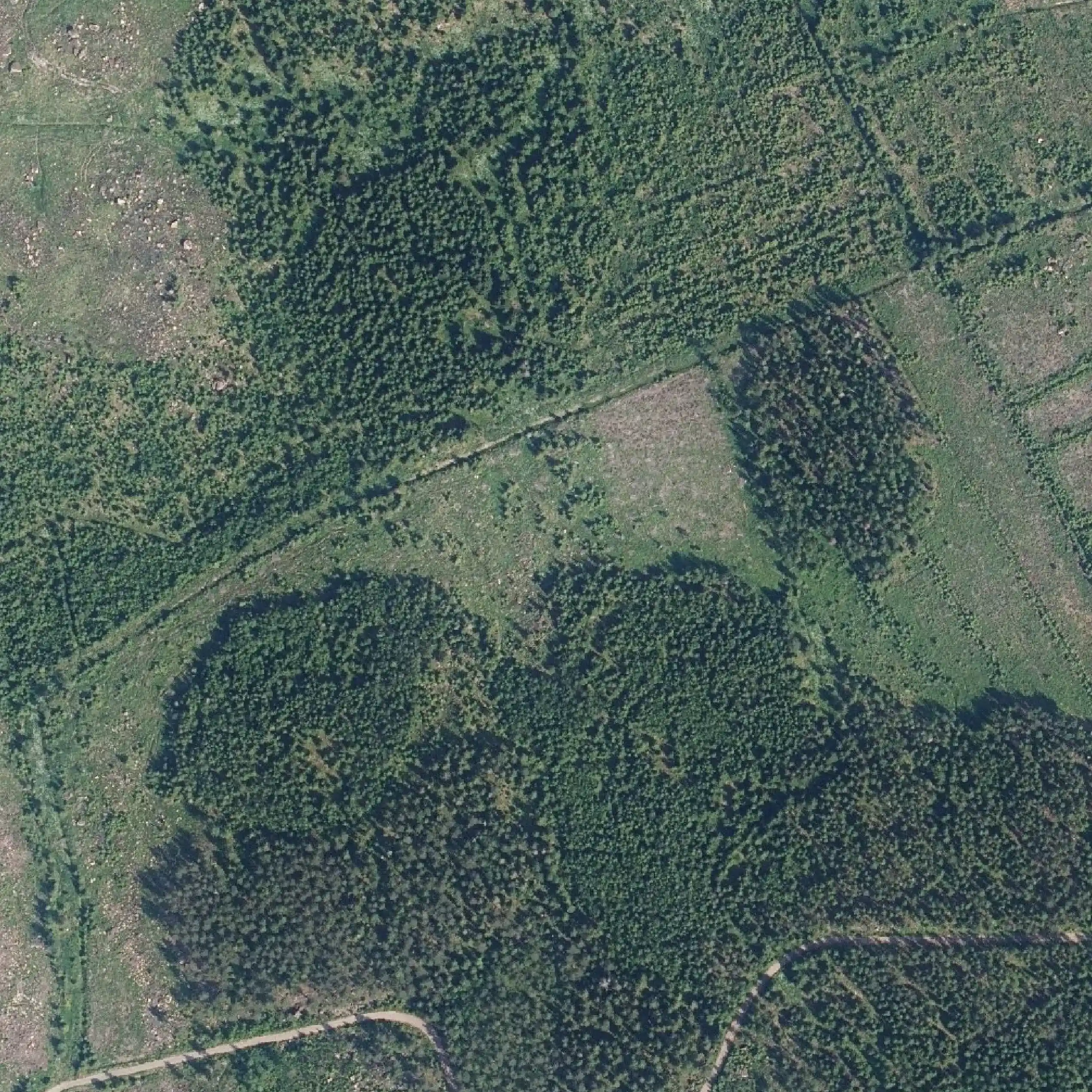
Limited visibility across your forest assets
With only one field plot per each of ~2,400 hectares actually observed, most of your forest remains uninspected. This gap leaves forest managers and owners reacting to problems they couldn’t see coming while slowing down decisions.
Arbonaut's solution
Clear situational picture at anytime
Remote sensing and GPS-positioned harvester data (HPR) deliver 100% wall-to-wall coverage for a complete and objective view. Replace slow field visits with stand-level metrics for a 20x boost in efficiency across your entire forest.
Pain point
Seasonal constraints for forest management
Winter conditions can restrict field access for 4-6 months per year, preventing consistent data collection across your forest. As the snow season remains the least productive period, it creates a recurrent planning bottleneck and further pressures shrinking harvest windows.
Arbonaut's solution
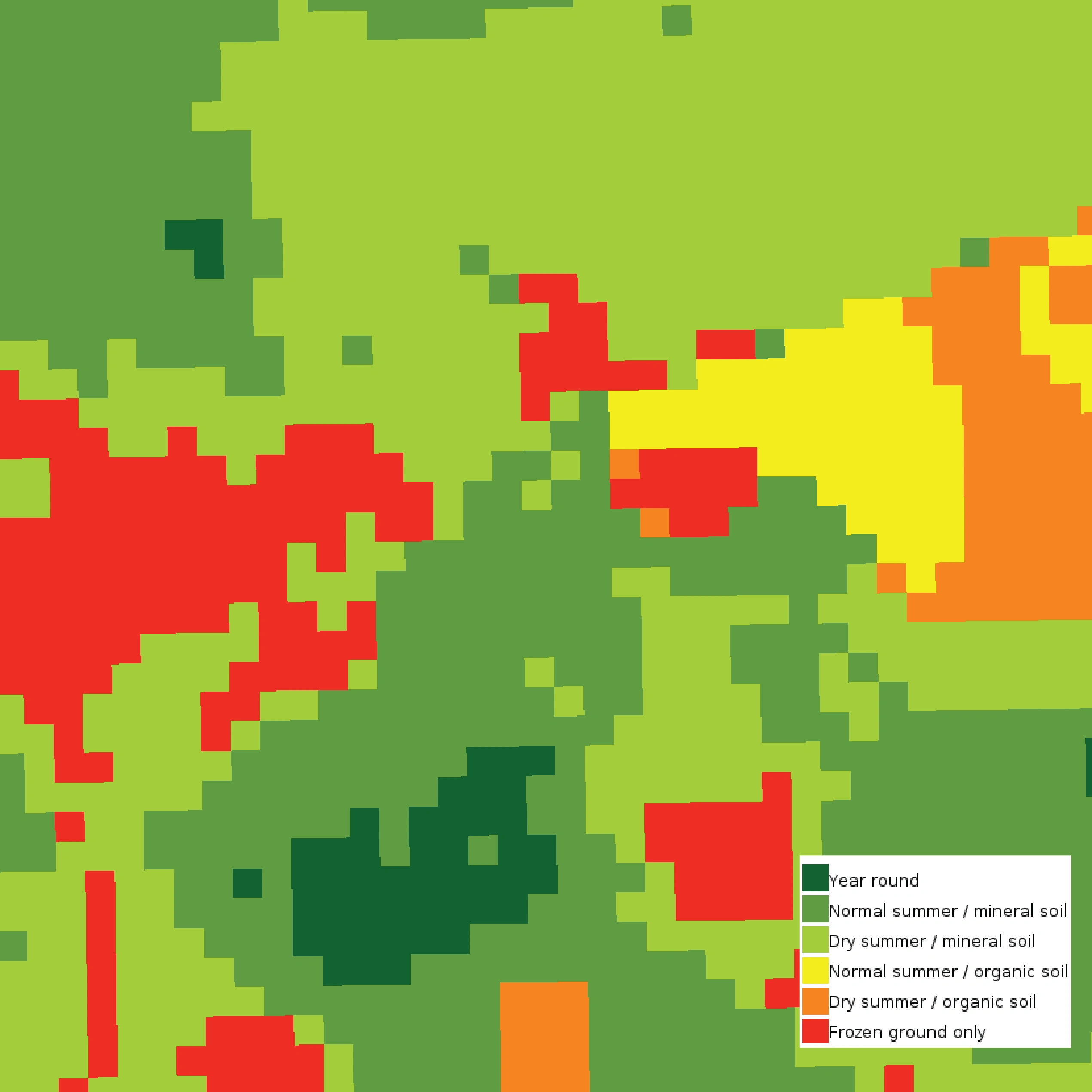
Turning seasonal limits into an operational advantage
Our remote sensing datasets provide year-round coverage, ensuring reliable data even when deep snow prevents fieldwork. Instead of a 6-month blackout, forest information stays current, allowing planning to go on throughout winter.

Pain point
3X workload from increasing planning requirements
Forest owners and managers manually check nature protection and social responsibility requirements across every stand. While increasing risks of accidental environmental damage, this triples the workload that could otherwise be spent on productive tasks.
Arbonaut's solution
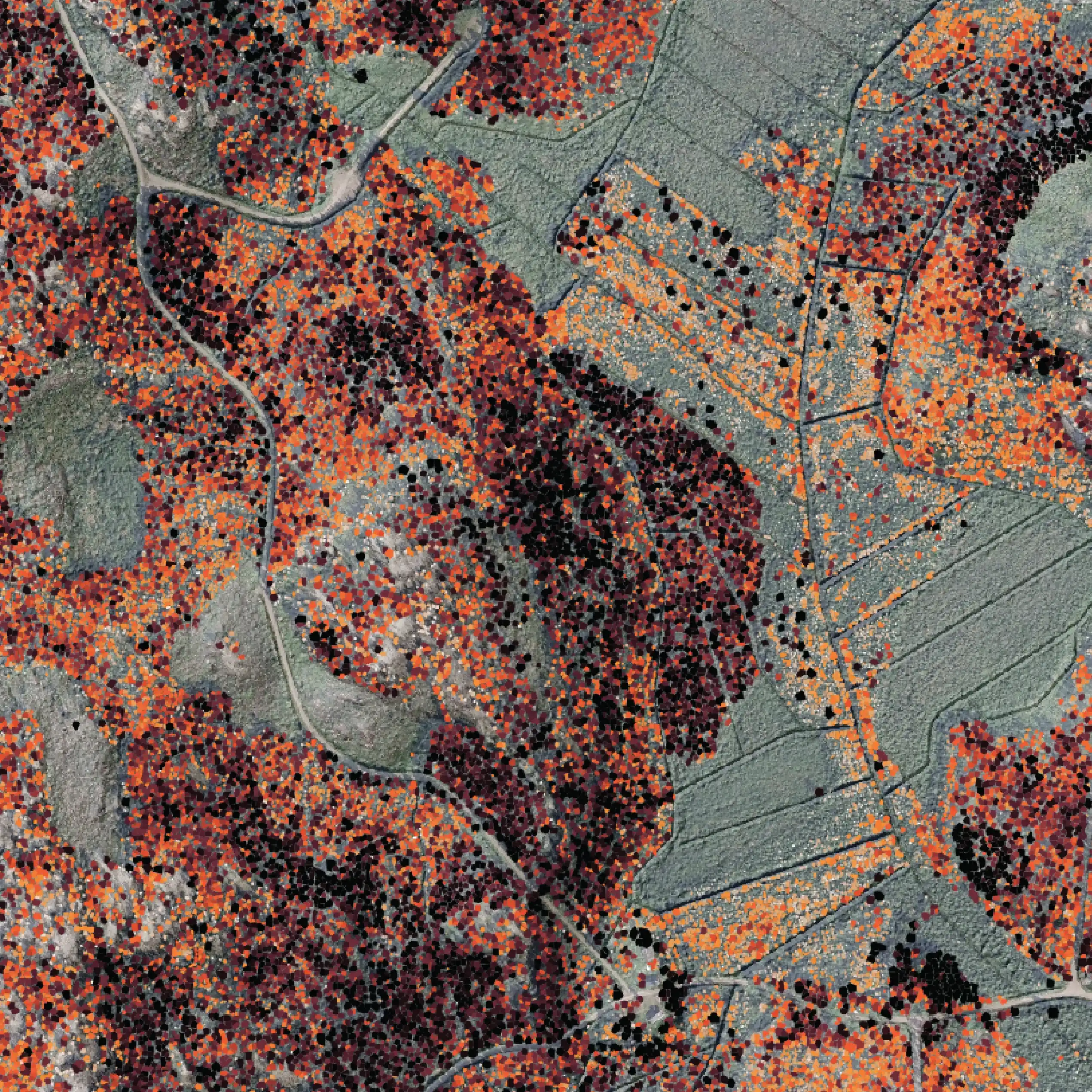
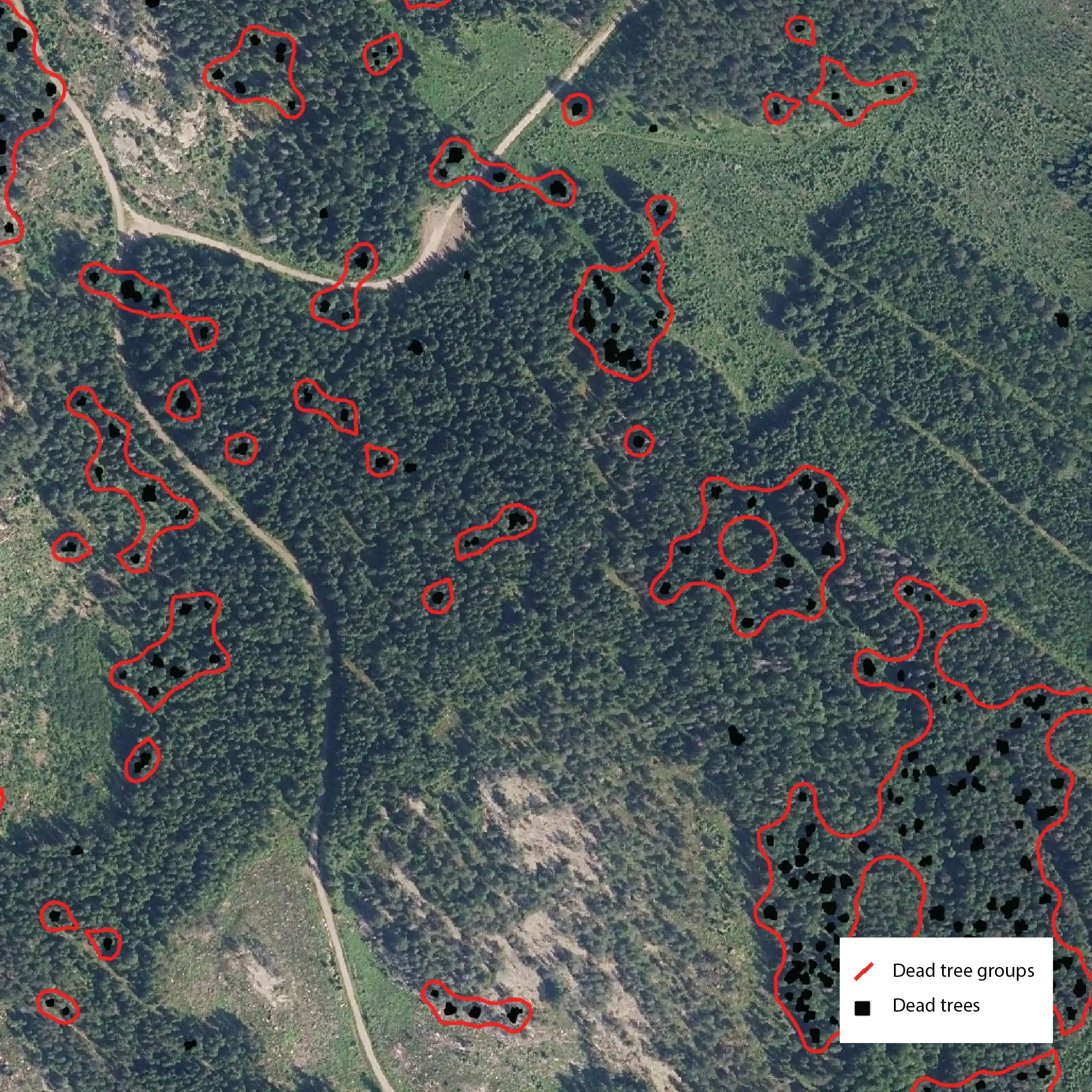
Nature value analysis
Our nature-value data lets you instantly identify key environmental considerations at a glance, reducing field visits. With no unintended harm to sensitive natural areas, you have clear evidence that every hectare is managed responsibly.
Your Forest is a Long-Term Investment
We give you the intelligence to manage it with accuracy and the foresight to protect its value.
 Cookie Policy