

Forest Road Analysis
Accurate mapping and condition assessment for safe and efficient forest operations.

Support Operations with Reliable Access Decisions
Arbonaut produces detailed forest road intelligence using LiDAR and AI to support accessibility and informed operational decisions. The analysis grants a consistent view of road condition and upkeep needs, helping prioritize actions and reduce reliance on time consuming field visits.
Patent-pending methodology
Proven approach across tens of thousands of kilometres of forest road networks
Road classification for immediate decision-making
Automated detection of road structure and geometry
A Complete View of Forest Road Conditions
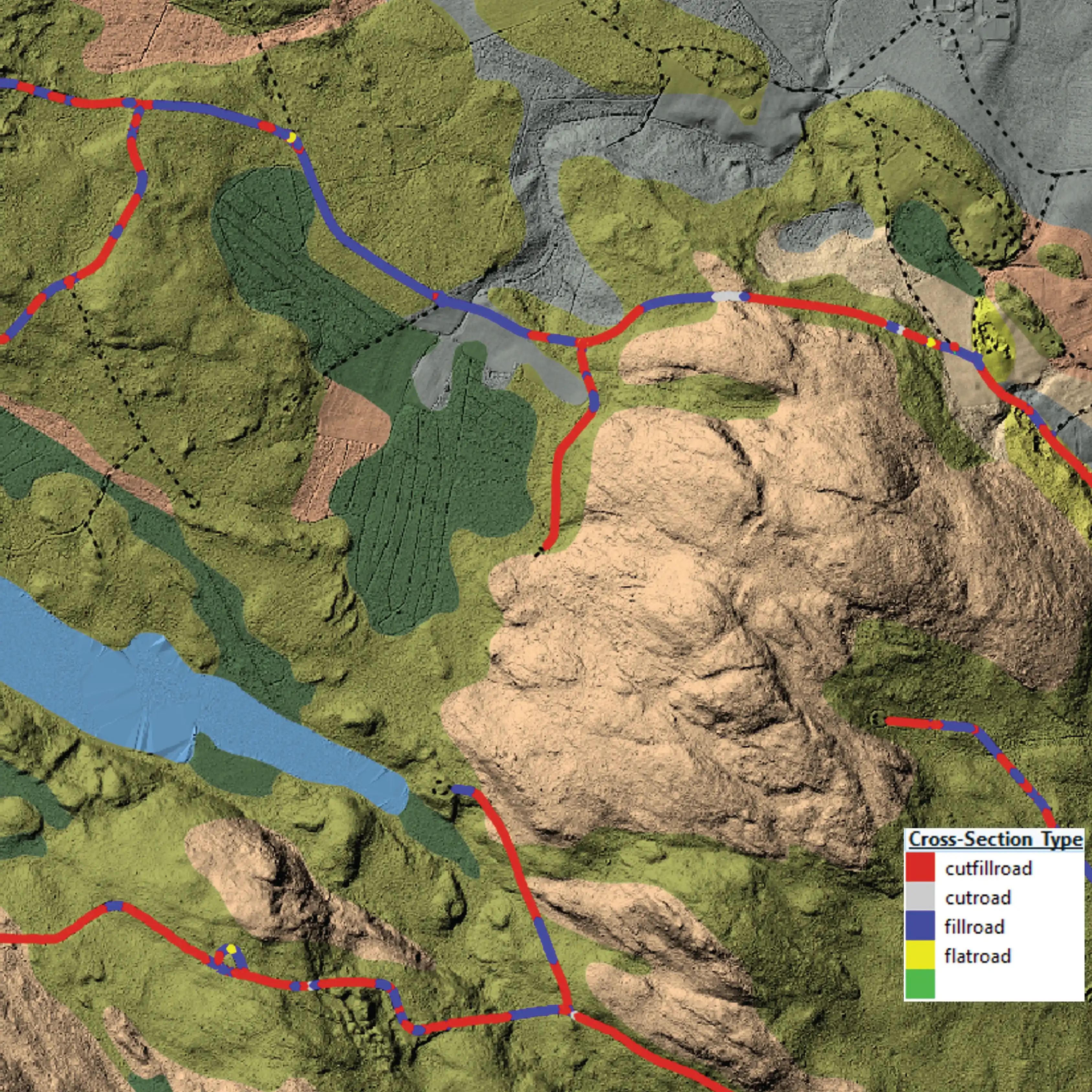
Automatic detections
LiDAR‑based features extracted consistently across the entire road network.
- See road conditions, width, and maintenance needs at a glance
- Get a clear view of ditches locations, drainage performance, and risks to road stability
- Understand road structure and long-term durability
- Instantly spot where roads deviate from standards based on our patent-pending approach
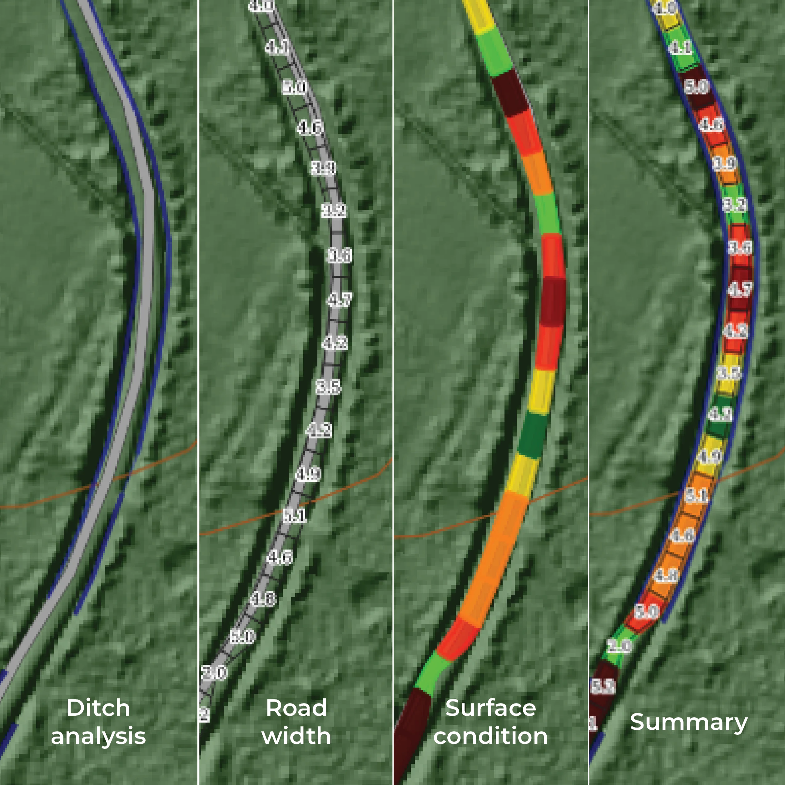
Road metrics
Translate road data into clear and actionable indicators for planning, operations, and investment.
- Know which roads support heavy transport and where restrictions or maintenance are required
- Understand how each segment fits maintenance and investment needs
- See the width and extent of the usable road surface
- Get early visibility into wheel ruts as a sign of structural weakness
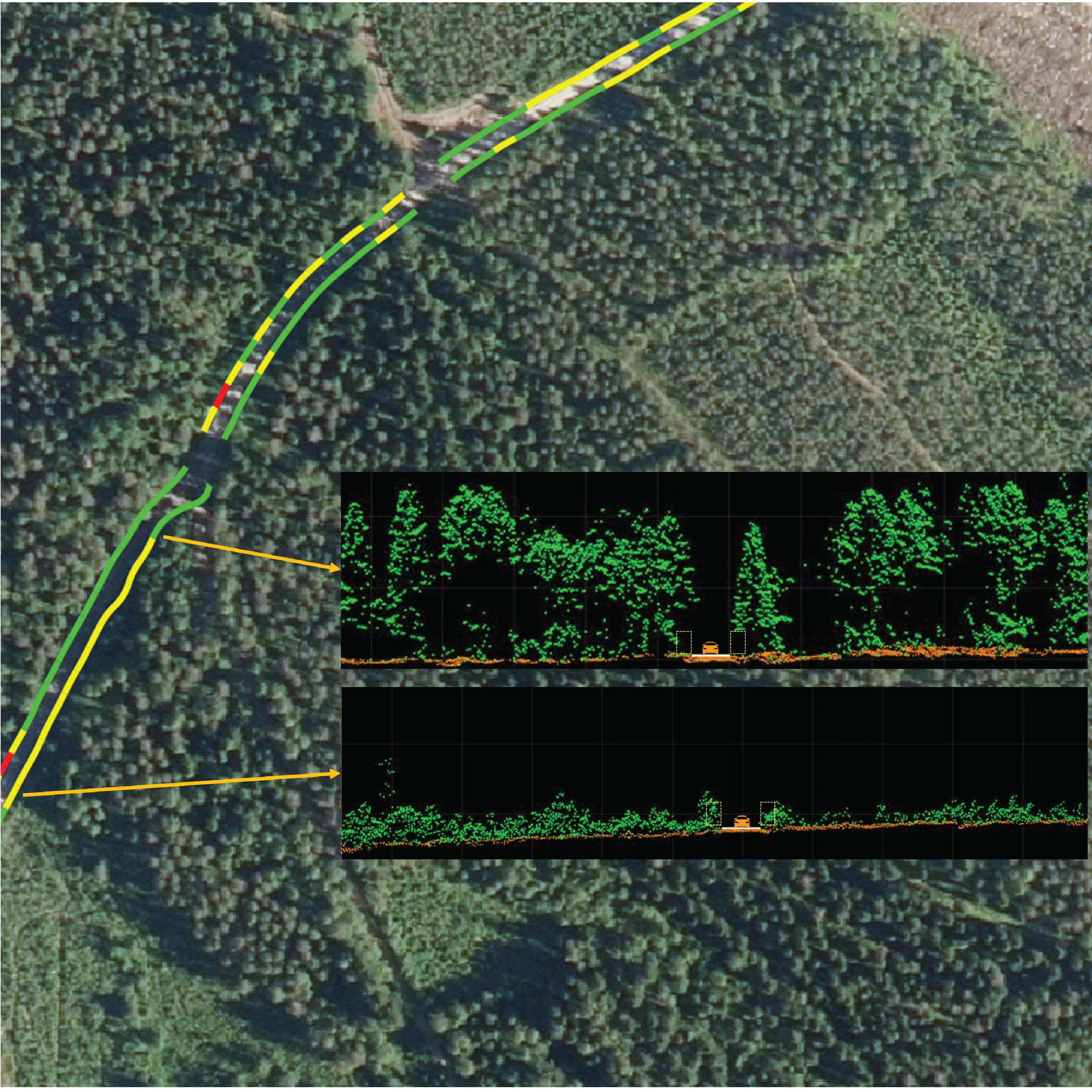
Available add‑on features
Optional analysis focused on visibility and operational safety.
- Identify vegetation encroachment into road corridors
- Locate road sections with limited visibility due to vegetation and terrain
Are Your Roads Ready for Forest Operations?
Get accurate road maps, condition insights, and operational guidance tailored to your forest.

Frequently Asked Questions
With LiDAR data, the analysis supports forest roads, gravel roads, and other unpaved road networks. It covers both main access roads and secondary operational roads across large areas.
Yes. Road conditions, drainage issues, structural weaknesses, and low‑visibility segments are all assessed remotely. This allows crews to be sent only to locations that clearly require attention, saving time and fieldwork costs.
Yes. All outputs are delivered via API or as standard GIS layers in common formats, ready to be integrated into GIS systems.
No. While designed for forest road management, the analysis also supports safer vehicle movement more broadly and can contribute to preparedness for emergencies such as forest fires, storms, and other accessibility‑critical situations.

 Cookie Policy