A 60,000-ha LiDAR‑based inventory enabling precision forestry
Arbonaut and MW Forest Sense delivered a complete LiDAR-based forest inventory covering 60,000 hectares across the Tärna-Stensele & Sorsele Övre (TSA-SÖA) regions in Sweden. The project provides a detailed understanding of forest conditions, supporting smarter timber collection and operational planning.
Traditional field-based inventory methods are slow, labor-intensive, and often not precise enough for modern forestry needs. TSA-SÖA needed reliable data to:
- Estimate standing timber volume
- Forecast growth more accurately
- Plan harvesting operations efficiently
MW Forest Sense subcontracted Opegieka to perform high‑resolution LiDAR scanning, while Arbonaut analyzed the data and produced detailed map products.
The LiDAR data enabled:
- Consistent and precise 3D forest structure mapping
- Species-specific diameter distribution analysis
- Improved stand-level growth forecasting
“The results can support forest planning in several ways. Improved timber stock estimates help identify suitable harvesting sites, while enhanced species-specific diameter distributions strengthen stand-level growth forecasting and product assortment evaluations. Together, these products help TSA-SÖA move toward precision forestry, where decisions and operations are tailored to the unique characteristics of each area.” — Ingrid Dorigetto, Project Manager & Remote Sensing Analyst, Arbonaut
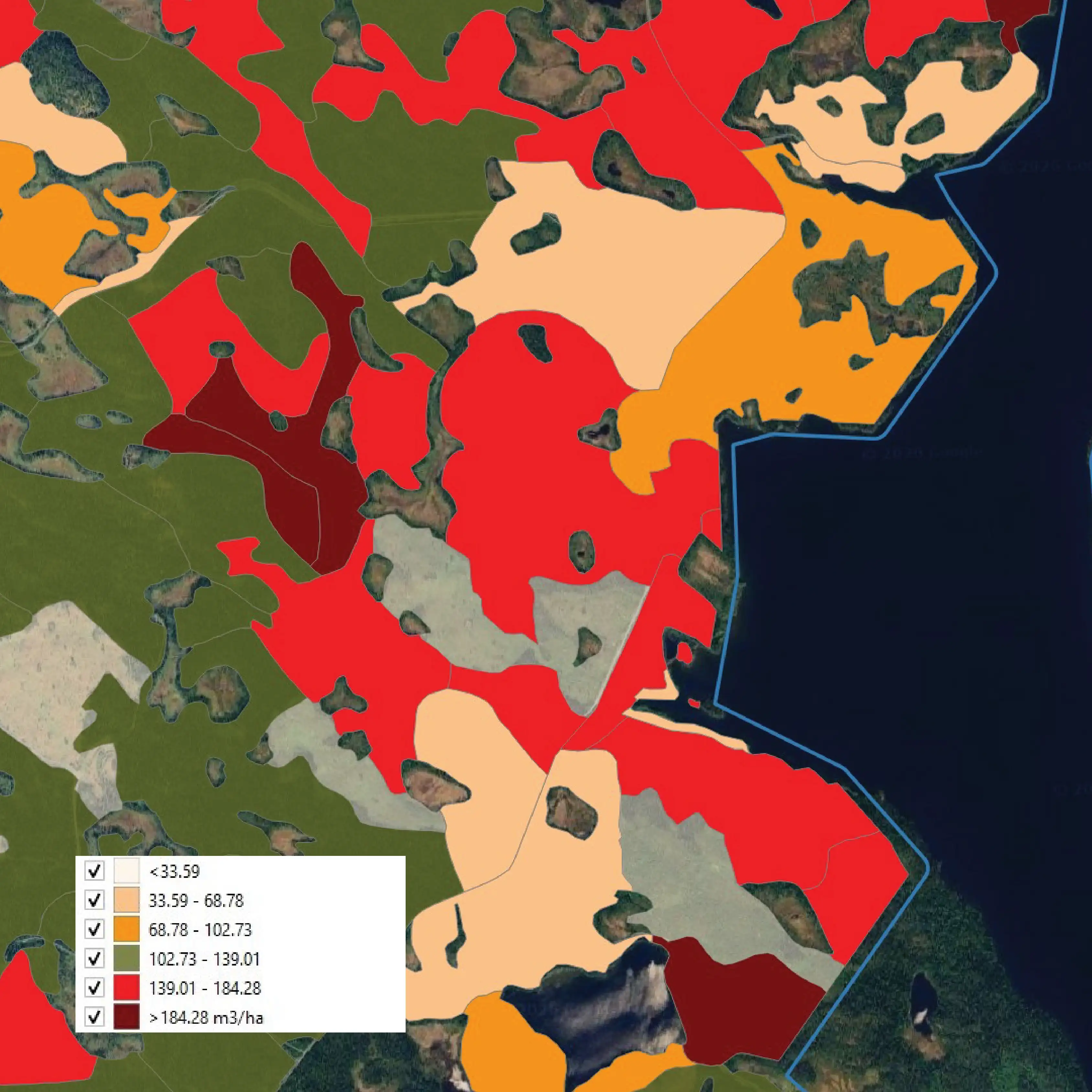
Volume m³
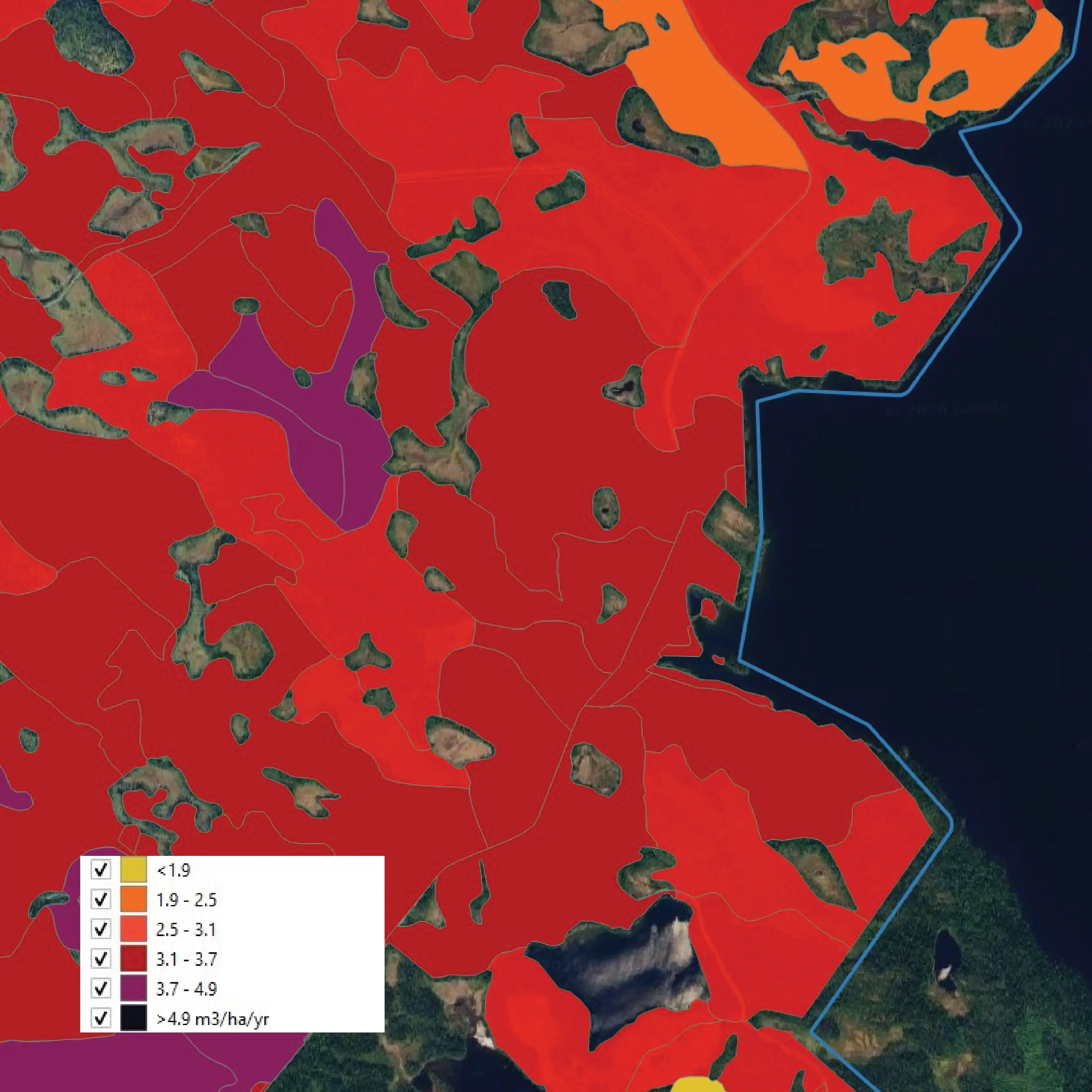
Growth potential per year m³/ha
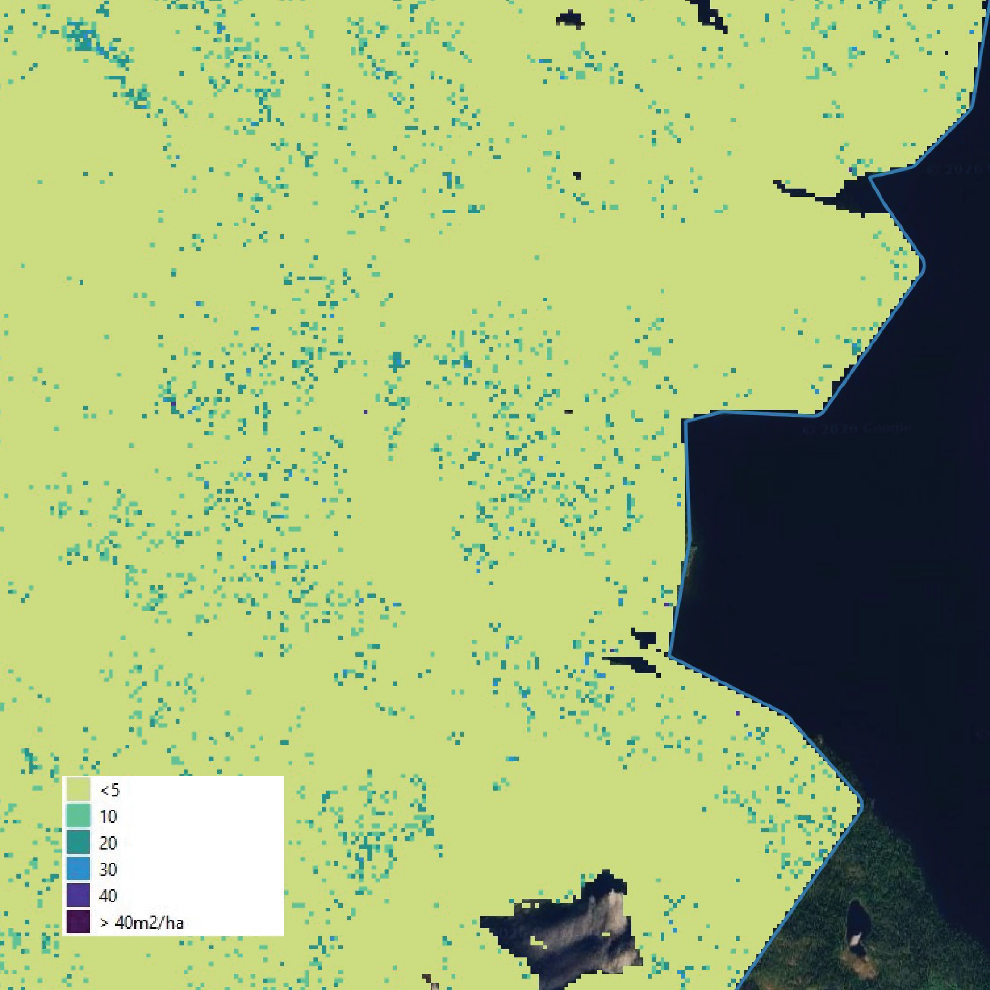
Thinning index m²/ha
TSA-SÖA now benefits from an accurate picture of their forest resources, enabling:
- Better harvest area prioritization
- Efficiency of vehicle mobility and route planning
- Reduced operational costs and time spent in the field
- Informed decision-making across all operations
About
Tärna-Stensele Allmänningsskog and Sorsele Övre Allmänningsskog are community-owned forest enterprises (allmänningsskogar) located in Västerbotten, Swedish Lapland. Both organizations operate as long-established forest management entities, responsible for coordinating forestry operations, land stewardship, and community benefits. Sorsele Övre Allmänningsskog provides access to extensive hunting grounds and fishing waters in a vast wilderness environment, while Tärna-Stensele Allmänningsskog covers approximately 55,000 hectares of forest and mountain-adjacent terrain between Storuman and Tärnaby.
 Cookie Policy