High‑Accuracy Deadwood Mapping
Make informed decisions with precise insights into tree mortality, forest health, and biodiversity conditions.
Reliable Detection of Deadwood at Scale
Deadwood signals both ecological value and potential operational risks before they are visible in the field by revealing tree stress and ecosystem changes. Arbonaut’s precise mapping of deadwood trees and clusters improves forest planning, reduces uncertainly, and strengthens long-term forest resilience without the cost of extensive ground surveys.
>90% accuracy for detecting large dead trees
For individual and cluster dead trees
Multiple data sources for optimal results
Seamless data integration into forest management systems
Complete Deadwood Mapping Outputs
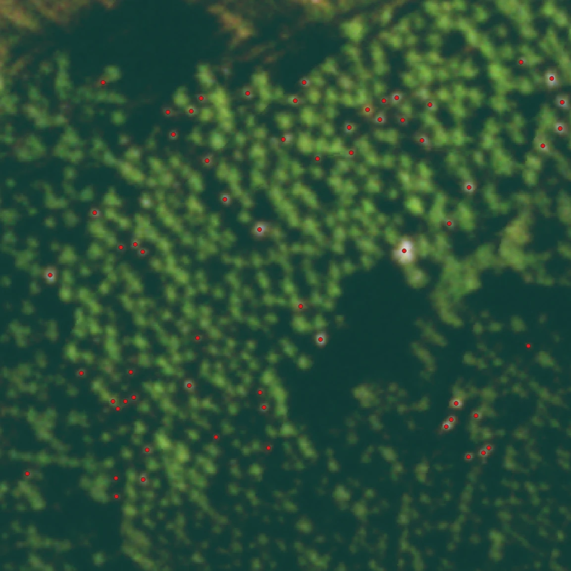
Points of dead trees
- Target your forest management operations with exact geolocation while reducing the need for field visits
- Prioritize the operations and allocate resources to the most affected areas with precise count of dead trees
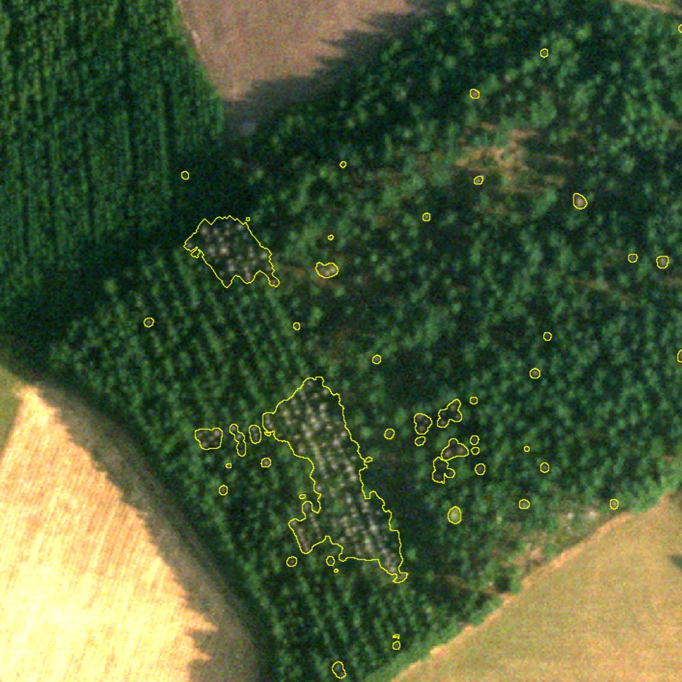
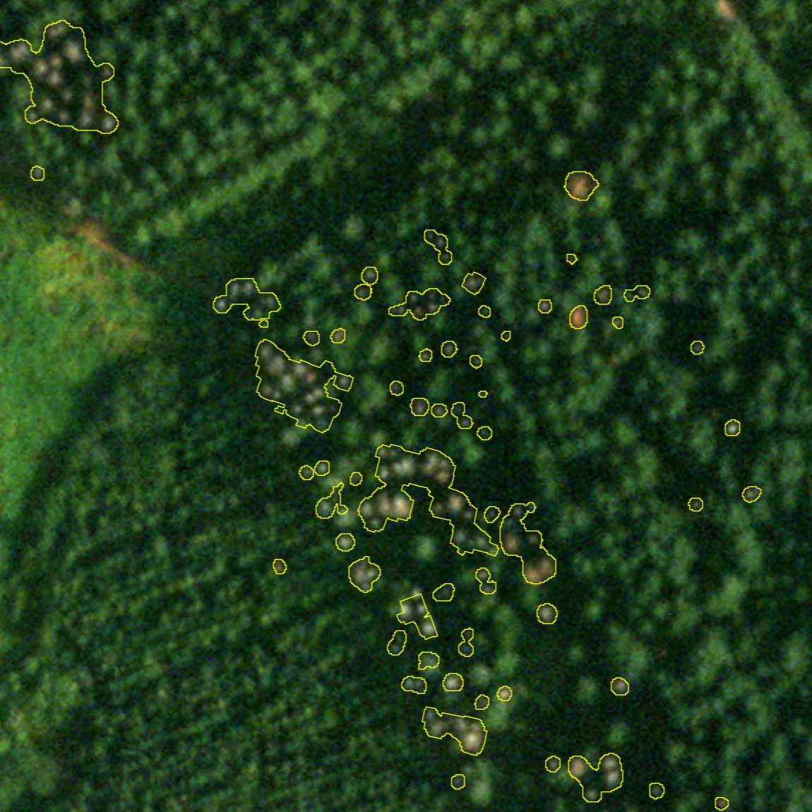
Delineated tree crowns
- Detect risk areas and evaluate the extent of damage with severity and affected area calculations
- Estimate m³/ha volume for biodiversity certifications (FSC/PEFC, etc.), carbon storage and sink calculations, and assessment of economical value of dead trees
Built for Accuracy, Coverage, and Cost-Effectiveness
Arbonaut selects the optimal combination of LiDAR and satellite that best matches your scale, timing, and budget
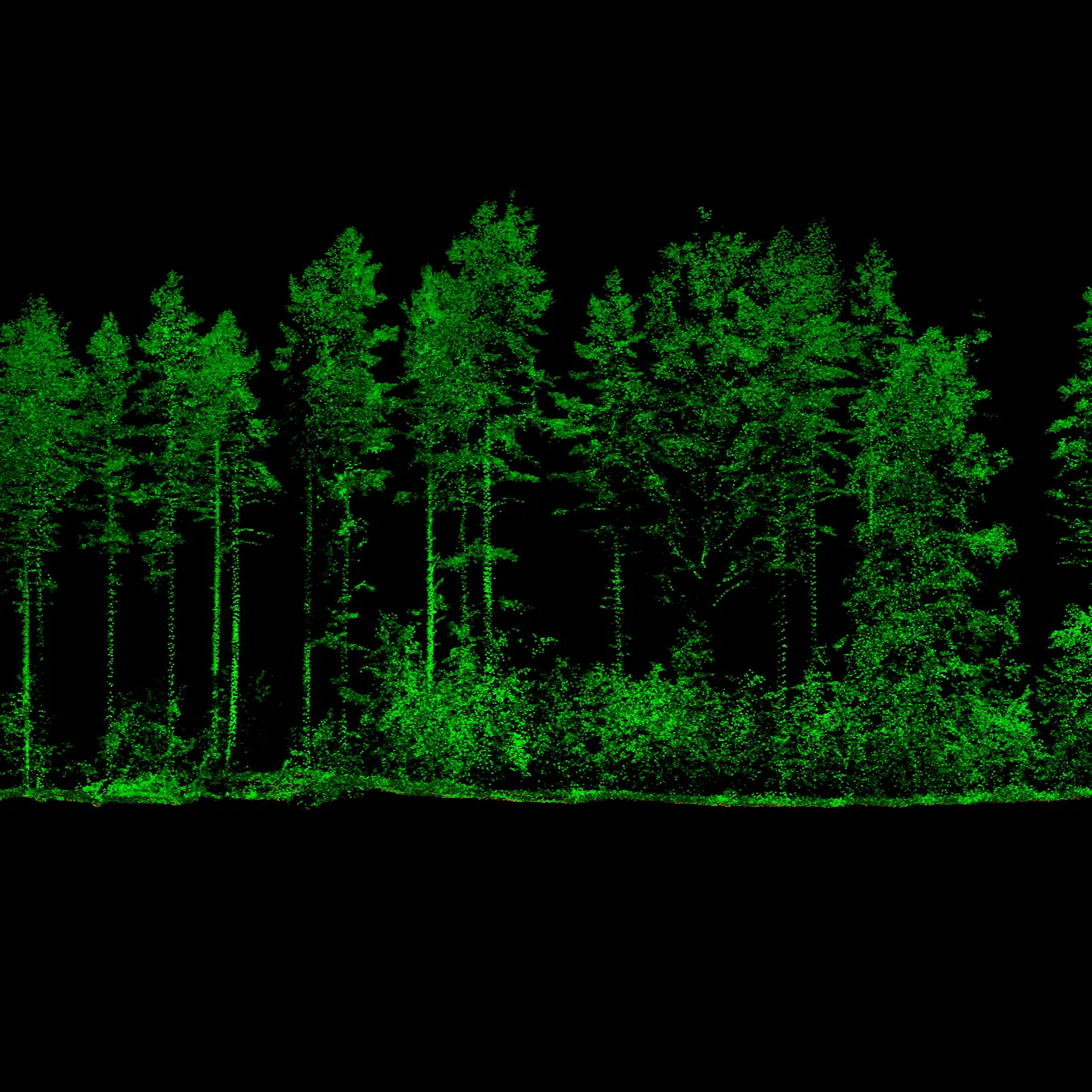
LiDAR
High-resolution commercial satellite imagery

Sentinel-2
How It Works
-
1. Your specifications
We discuss the area of interest, data requirements, and target outputs.
-
2. Data acquisition
We order high-resolution satellite imagery and/or remote sensing, or existing satellite imagery is selected from catalogues.
-
3. Analysis
Arbonaut processes the data using LiDAR and/or satellite imagery with our deadwood detection models.
-
4. Result delivery
You receive GIS-ready layers in your preferred format.
Get A Clear Picture of Forest Mortality
See exactly what is happening on the ground before it affects asset value, forest planning, and operations.
Frequently Asked Questions
 Cookie Policy