ArboField
A reliable mobile app developed with an offline‑first, mobile‑first mentality.
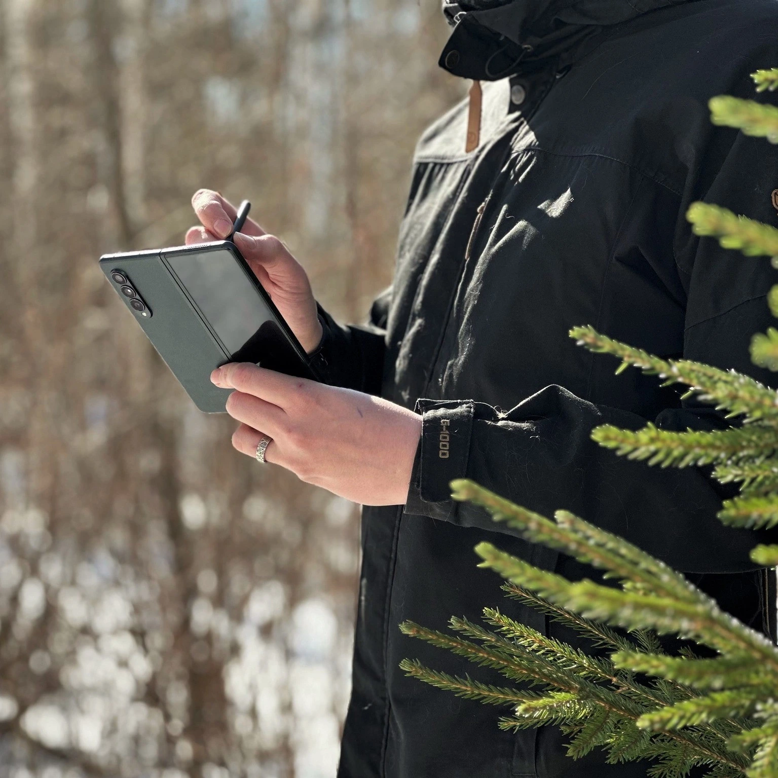
Forest Insights on the Go
ArboField is crafted specifically for field teams and professionals working in remote, rugged field conditions. Rapidly developed from scratch with an agile build process, the app is customized and deployed to you. Your organization’s own version will be available directly through the Google Play Store.
Personalized field experience with adaptable UI
High usability for varied field setups
Low upkeep and long-term stability
Complete functionality without network access
Available integrations into your IT systems
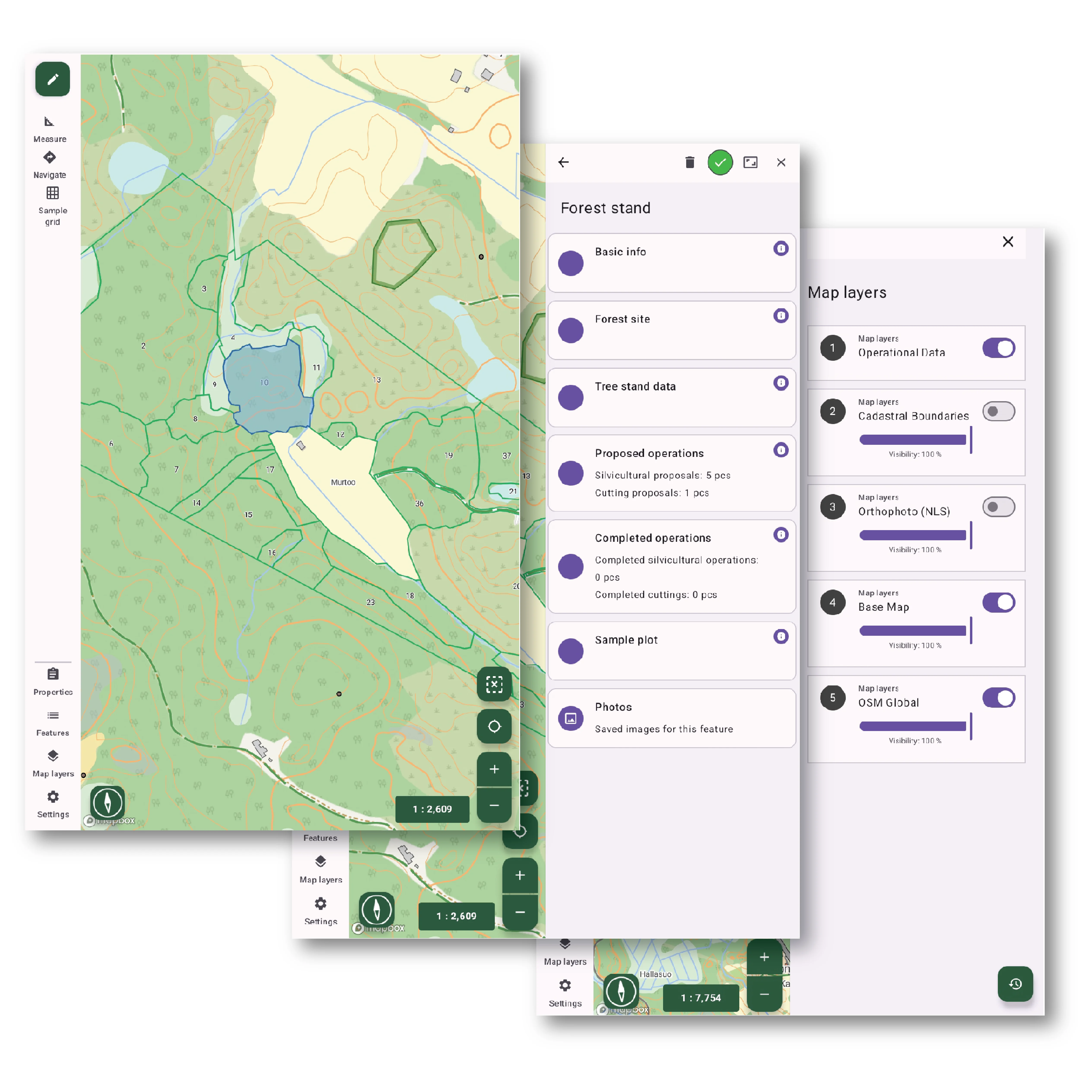
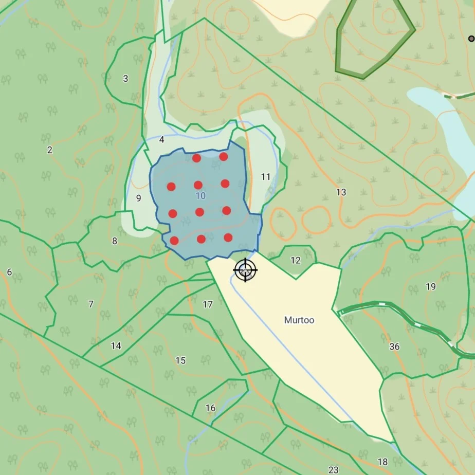
Forest stands and environmentally important habitats
Leverage on forest resources and environmentally important habitats.
- Record and update stand boundaries with advanced geometry tools including GPS
- Enter and validate forest attributes
- Add information on valuable habitats
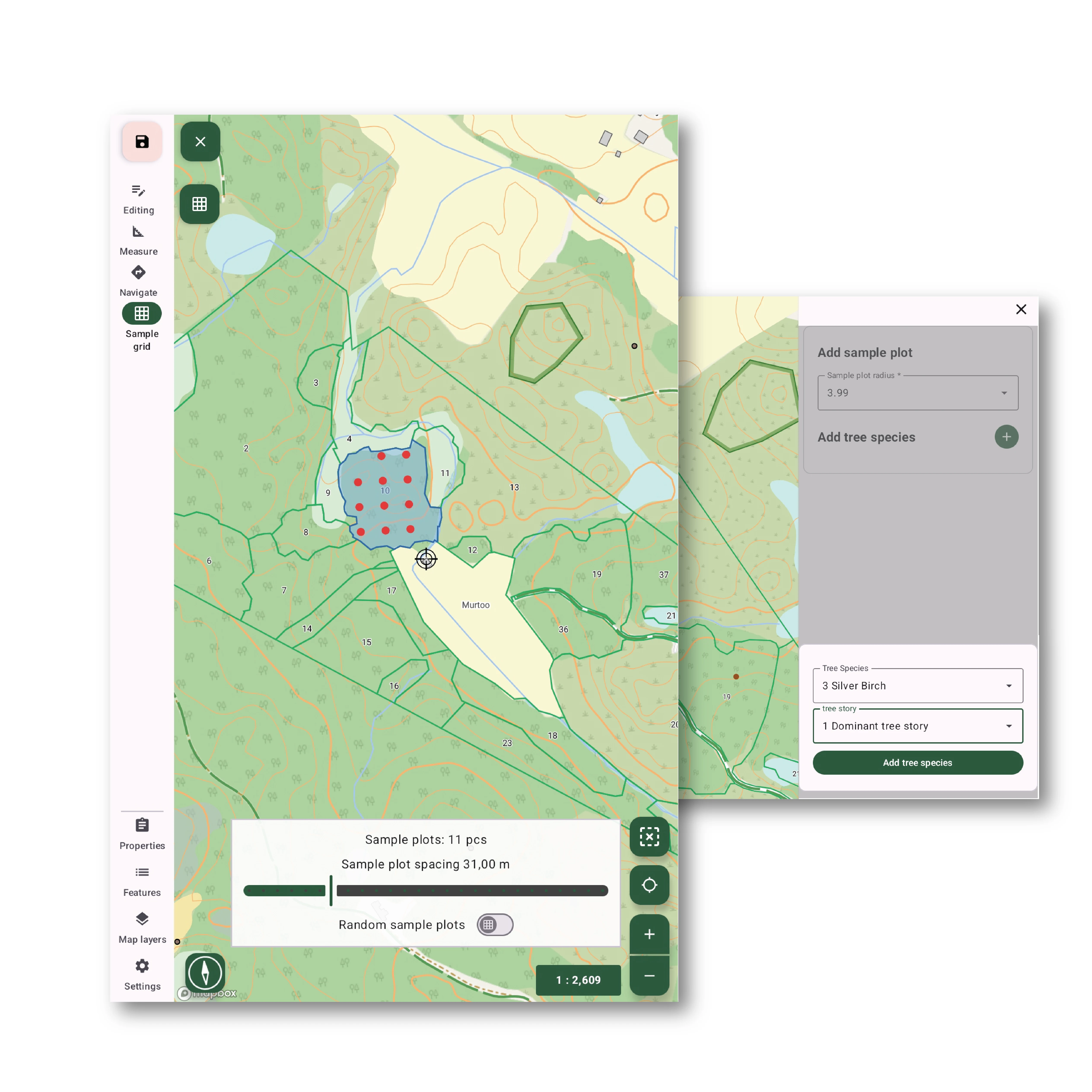
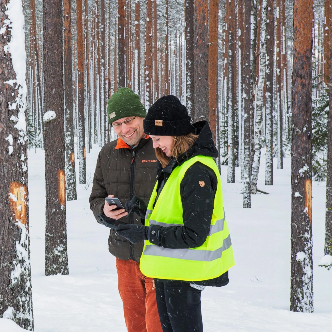
Collect precise field data using flexible plot configurations
Leverage on forest resources and environmentally important habitats.
- Automated plot grids with adjustable spacing or randomized placement
- Add sample plots using radius or relascope methods
- Collect and record tree measurements
- Fully tailorable parameters: plot radius, tree species, tree stratum/story, and more
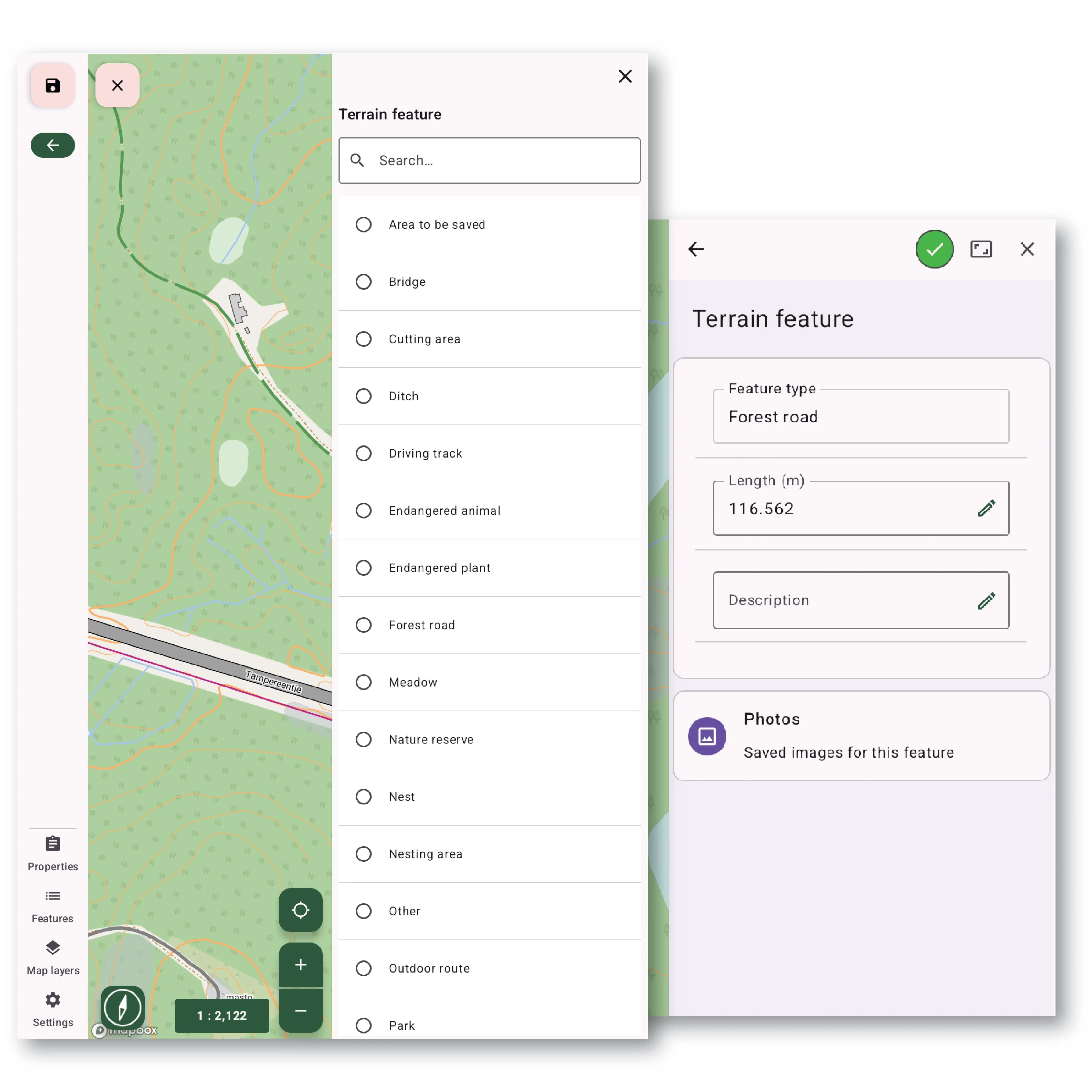
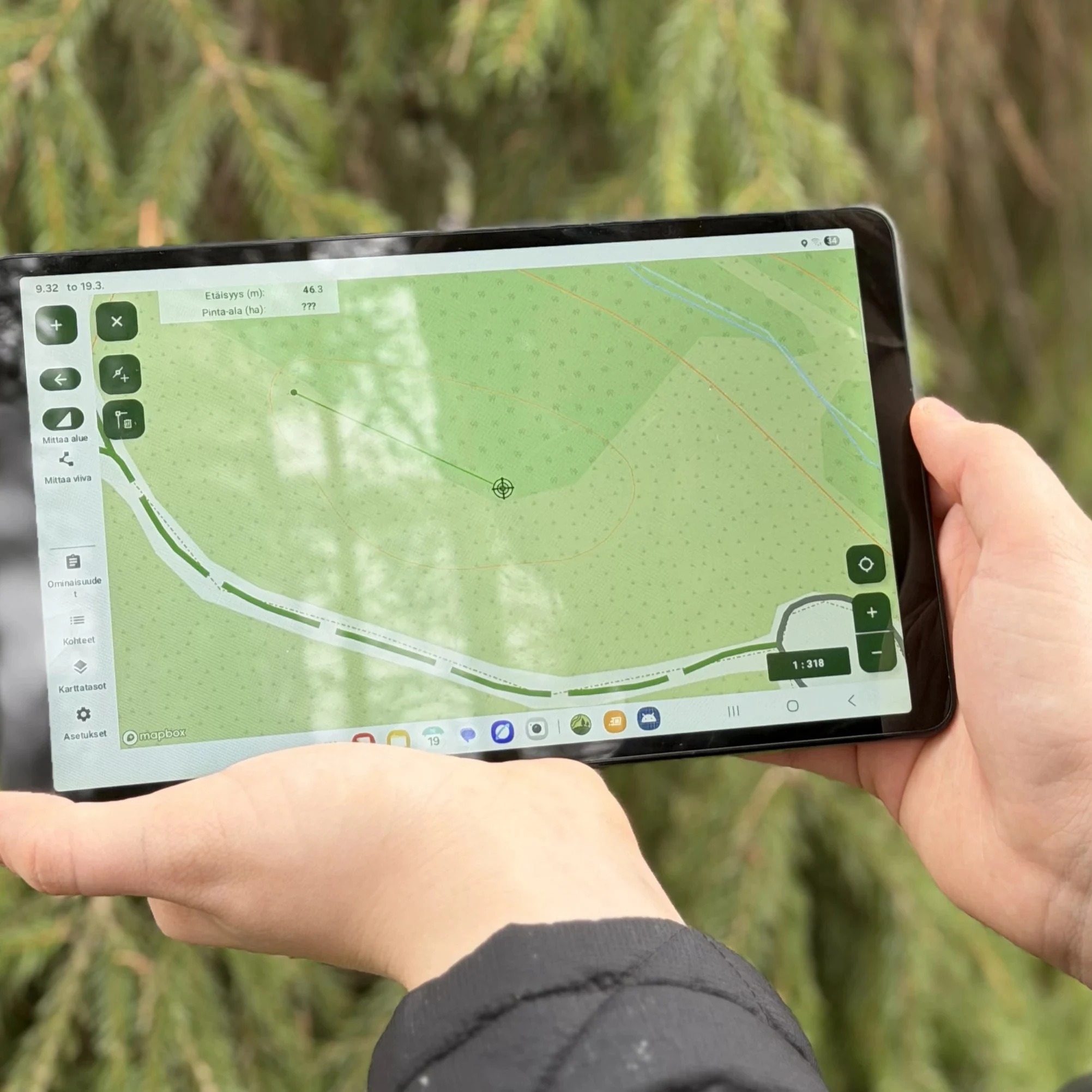
Terrain features
Document terrain conditions directly in the field.
- Add points, lines, or polygons using GPS or by tapping on the map
- Customize object types and map styling to match your workflow
- Attach additional information such as photos, videos, descriptions, and other tailored attributes
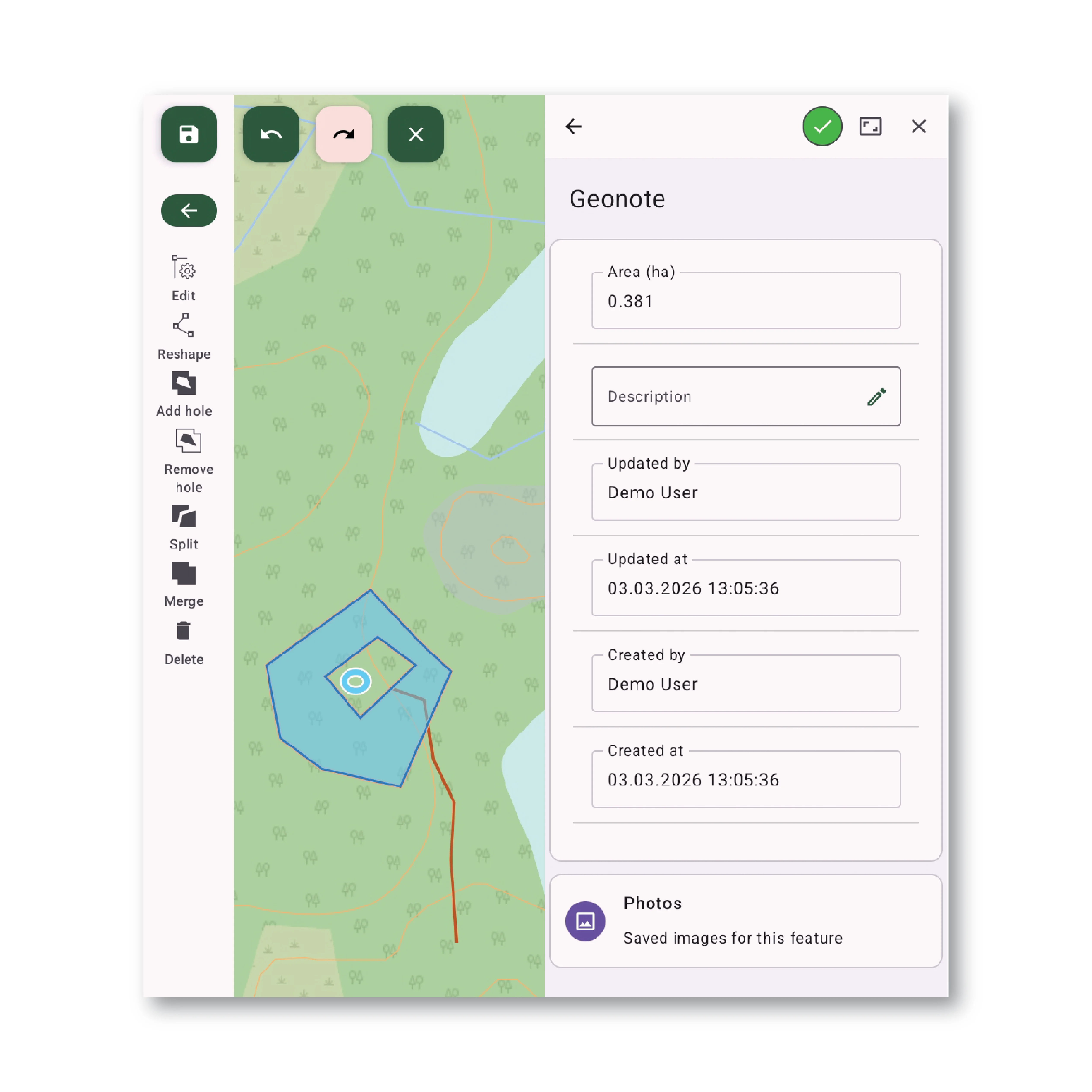
Geonotes
Capture observations and field notes with geospatial context.
- Add geonotes as points, lines, or polygons, via GPS or map interaction
- Enrich notes with photos, videos, descriptions, and optional custom fields
- Full editing tools to modify geonote directly in the app
-
High Performance Mapping Tools for Field Mobility
ArboField delivers a fast and intuitive GIS experience. Users can work with multiple offline basemaps, toggle operational layers, view GPS position in real time, and interact with features directly on the map. Custom map styles ensure clarity in dense forest conditions, while advanced navigation tools support routing, tracking, and precise positioning even with weak GNSS signals. -
Versatile Geometry Editor
ArboField lets you easily edit all 2D geometries. Customizable validation rules keep every geometry clean and error‑free. A glove‑friendly, pen‑optimized interface makes outdoor edits easy, and GPS lets you capture geometry just by walking. -
Seamless Data Flow Between the Field and Your Central System
All collected data synchronizes effortlessly with your backend. Offline edits are stored locally and automatically synced once internet connectivity is restored, ensuring no data loss in remote environments. -
Easy Rollout and Centralized Management at Any Scale
Your custom ArboField application is distributed through the Google Play Store, enabling quick deployment and straightforward updates across teams. The app adapts to your workflows, offering tailored forms, customizable layers, and preconfigured surveys for immediate use in the field.
Ready to Take Your Fieldwork to the Next Level?
ArboField is made for teams who work deep in the forest and need dependable insights on the spot.
Frequently Asked Questions
Yes. ArboField can be integrated with more IT environments. Our team supports custom integrations, including APIs and compatibility with other GIS platforms.
Yes. We provide ongoing maintenance and support services, including regular updates, security patches, feature enhancements, and stability monitoring to ensure continuous system performance. This helps ensure the app runs smoothly for years and remains future‑proof, maximizing long‑term value and your return on investment.
Absolutely. ArboField is designed for any sector that requires GIS-based data collection, mapping, or fieldwork documentation. If collecting spatial data is part of your workflow, the app can be customized to fit your operational needs.
 Cookie Policy