


A 148,000-ha Inventory of Standing Deadwood Supporting Biodiversity and Large-Scale Forest Management
Metsähallitus awarded Arbonaut with a tender for deadwood mapping that covered 148,000 hectares of forest inventory stands. Deadwood is a key structural component of boreal forest ecosystems and provides critical habitat for numerous red-listed and threatened species. Alongside the age of the trees, the amount and distribution of deadwood are therefore important indicators of biodiversity value and ecological continuity.
Background
Information on deadwood is increasingly used in conservation planning, biodiversity assessments, and the identification of old-growth forests. In the pine-dominated forests of Northern Lapland, the current old-growth forest criteria require a minimum deadwood volume of 10 m³/ha (including both standing and laying deadwood).
Traditional field-based deadwood inventories are time-consuming, limited in spatial coverage, and often insufficient for large-scale ecological assessments. Additionally, remote-sensing based data collection is the most efficient method due to vast inaccessible areas within Lapland.
Metsähallitus required reliable data to:
- Identify individual standing dead trees across large forest areas
- Improve monitoring of biodiversity-related indicators
- Support conservation and habitat analysis
- Enable more efficient planning of forest operations
Solution
Arbonaut delivered a detailed single-tree inventory of standing dead trees. Using high-resolution aerial imagery provided by the National Land Survey of Finland, Arbonaut performed the interpretation of standing dead trees.
The objective of this project was to detect individual standing dead trees using openly available orthophotos provided by the National Land Survey of Finland (NLS).
The resulting dataset includes precise spatial outputs and standardized formats for seamless integration into forest information systems. The delivered outputs included:
- A point layer containing the exact geospatial location (X and Y coordinates) of each detected standing dead tree.
- Crown polygons representing the delineated crowns of detected standing dead trees (DBH ≥ 10 cm).
- Stand-level estimates of standing deadwood volume (m³/ha) for the inventory stands provided by the client.
- A final report describing the methodology and the achieved inventory accuracy.
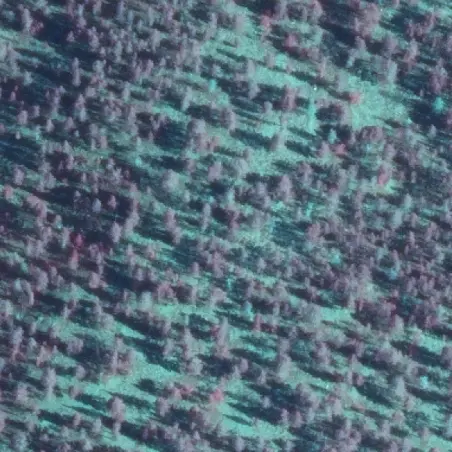
Before AI detection
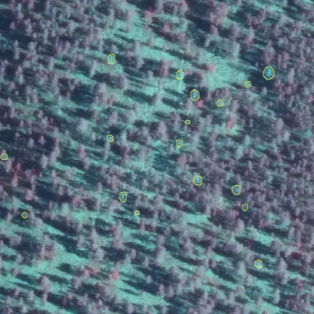
Detected deadwood
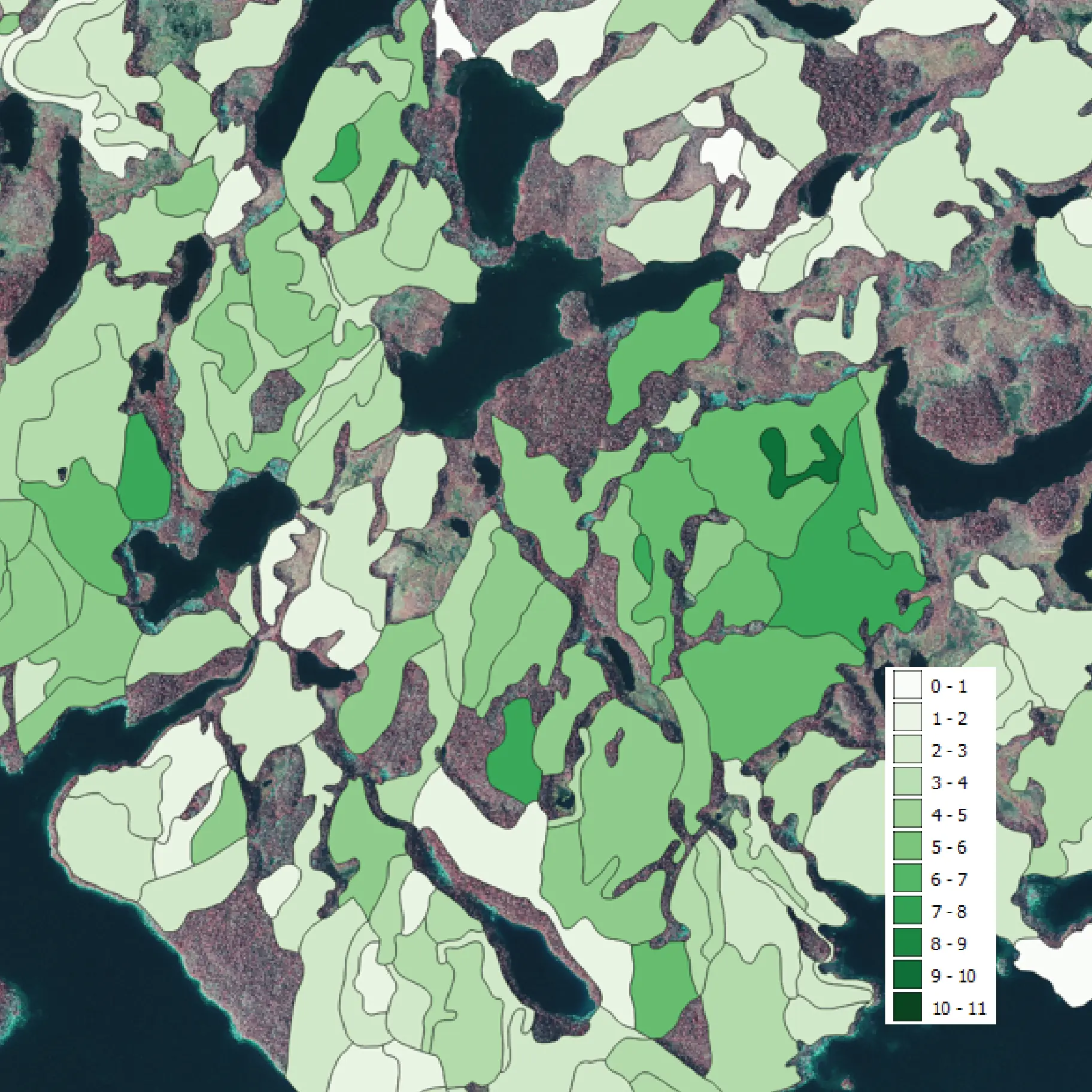
Standing deadwood volume
Value
Metsähallitus now benefits from a comprehensive and spatially explicit view of deadwood resources, enabling:
- Improved biodiversity and habitat assessments
- More informed conservation planning
- Reduced need for extensive field surveys
- Enhanced planning of field surveys based on reliable geospatial data
Beyond the immediate inventory benefits, this work demonstrates how modern AI-based remote sensing can support landscape-scale biodiversity monitoring.
At a broader scale, such information can contribute to improved conservation planning, more efficient identification of old-growth forest candidates, and better monitoring of forest biodiversity across northern boreal landscapes.
About Metsähallitus
Metsähallitus is a state enterprise that manages one third of Finland's land and water areas. It’s wholly-owned subsidiary, Metsähallitus Forestry Ltd, is responsible for managing state-owned commercial forests and providing sustainable wood supply. The organization plays a key role in balancing commercial forestry, biodiversity conservation, and recreational land use across Finland.

 Cookie Policy