


WI4EURECA Consortium Awarded Phase 2 of the PCP WISE Project

After successfully completing Phase 1 of PCP WISE, our WI4EURECA consortium has been awarded Phase 2 of the project. Arbonaut is proud to continue partnering with Planetek Italia, Latitudo 40, Agricolus S.r.l., Tracasa Global, Kompetenzzentrum Wasser Berlin (KWB), and D-Orbit to develop innovative solutions for climate resilience, environmental monitoring, and sustainable water management across Europe.
Background
Climate change is causing severe global problems, such as droughts, floods, and disruptions in water supply. These issues also affect soil stability, water quality, and increase the risk of wildfires. It creates enormous potential for damage.
The WI4EURECA stands for Water Intelligence for European Urban and Rural Environmental & Climate Assessment. The project addresses some of Europe's most pressing climate challenges:
- Droughts
- Floods
- Wildfires
- Heat stress
- Land subsidence
- Impacts of climate change on urban and rural environments
Through PCP WISE, we are combining satellite Earth Observation, LiDAR, AI, hydrological modelling, and geospatial analytics to transform environmental data into actionable intelligence for climate adaptation, disaster risk reduction, water resource management, environmental monitoring, and emergency response.
WI4EURECA: Arbonaut's contribution
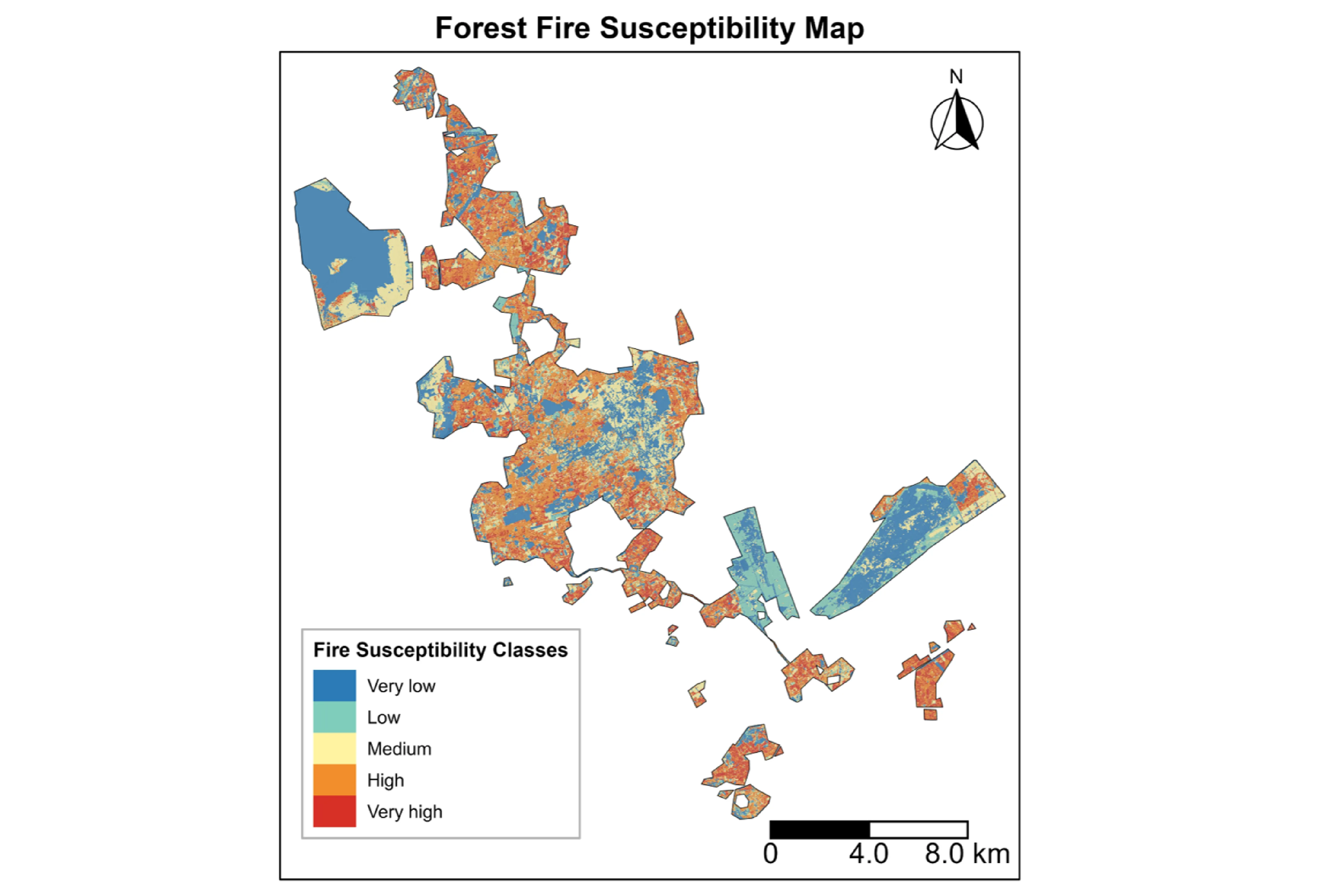
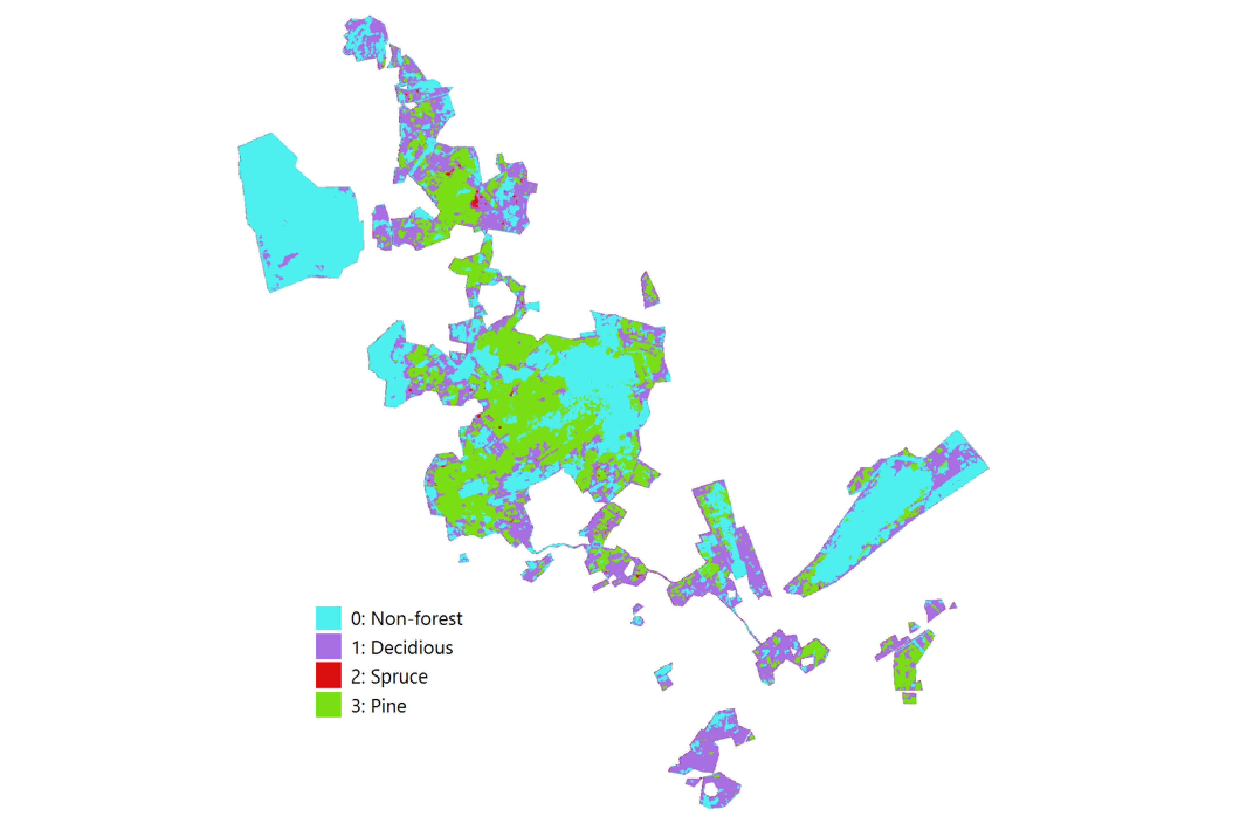
During Phase 1, Arbonaut developed detailed wildfire fuel maps describing surface and canopy fuels, carried out wildfire susceptibility assessments, and analyzed wildland-urban interface fire risk around buildings and roads to better understand where people and assets may be most exposed to future wildfire impacts. We also produced high-resolution terrain and vegetation structure datasets, providing detailed information on ground elevation and forest canopy characteristics to support hydrological and environmental modelling.
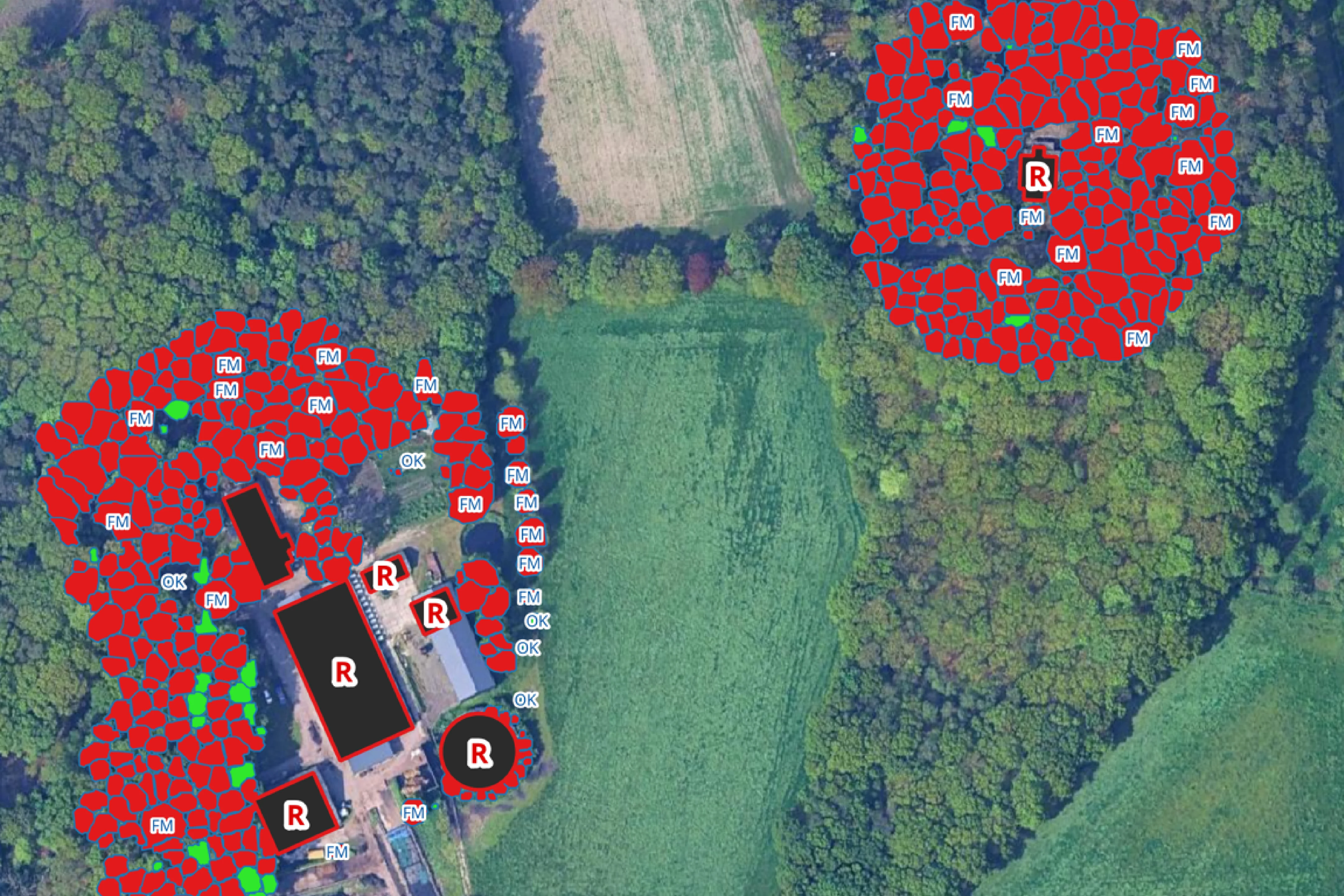
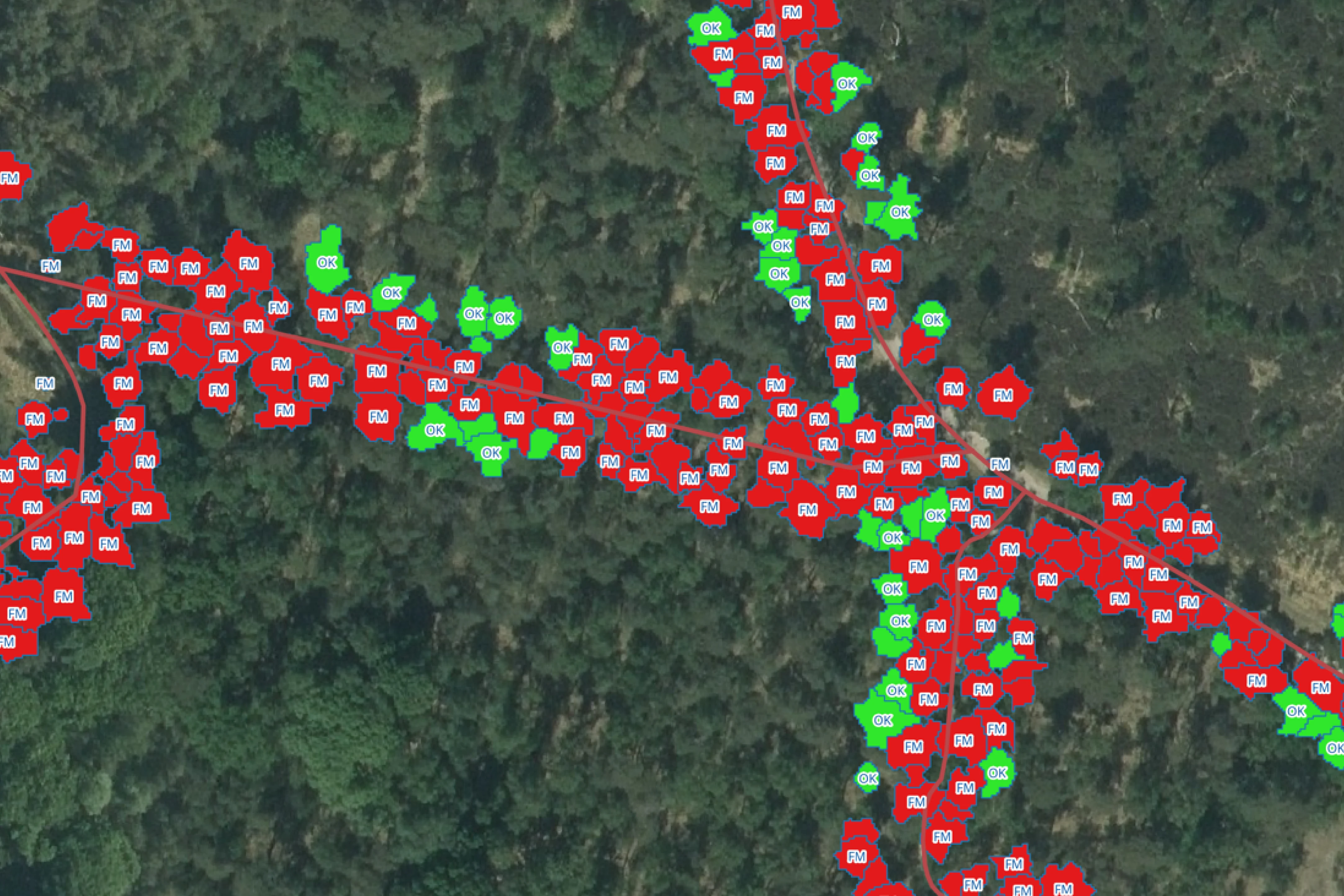
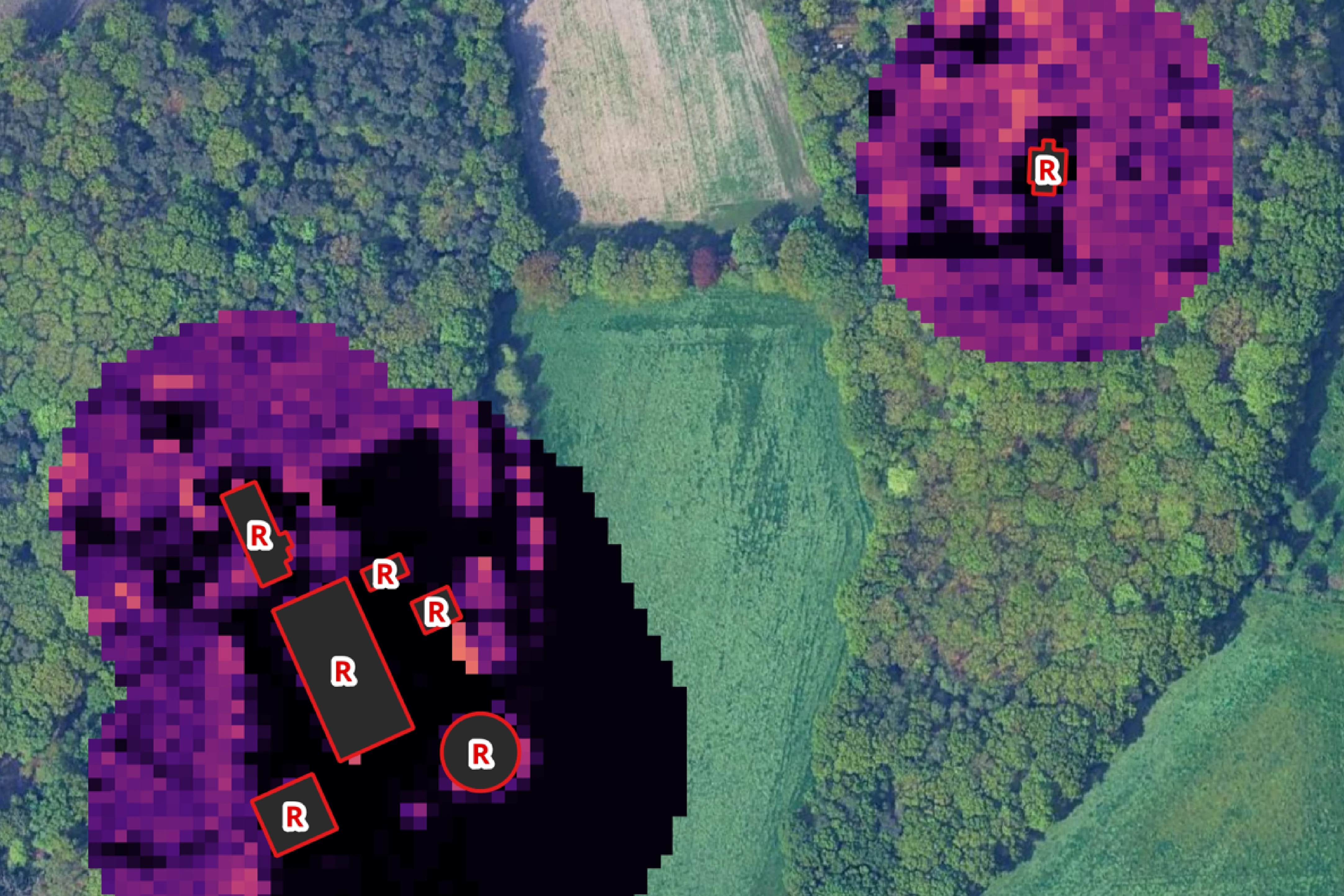
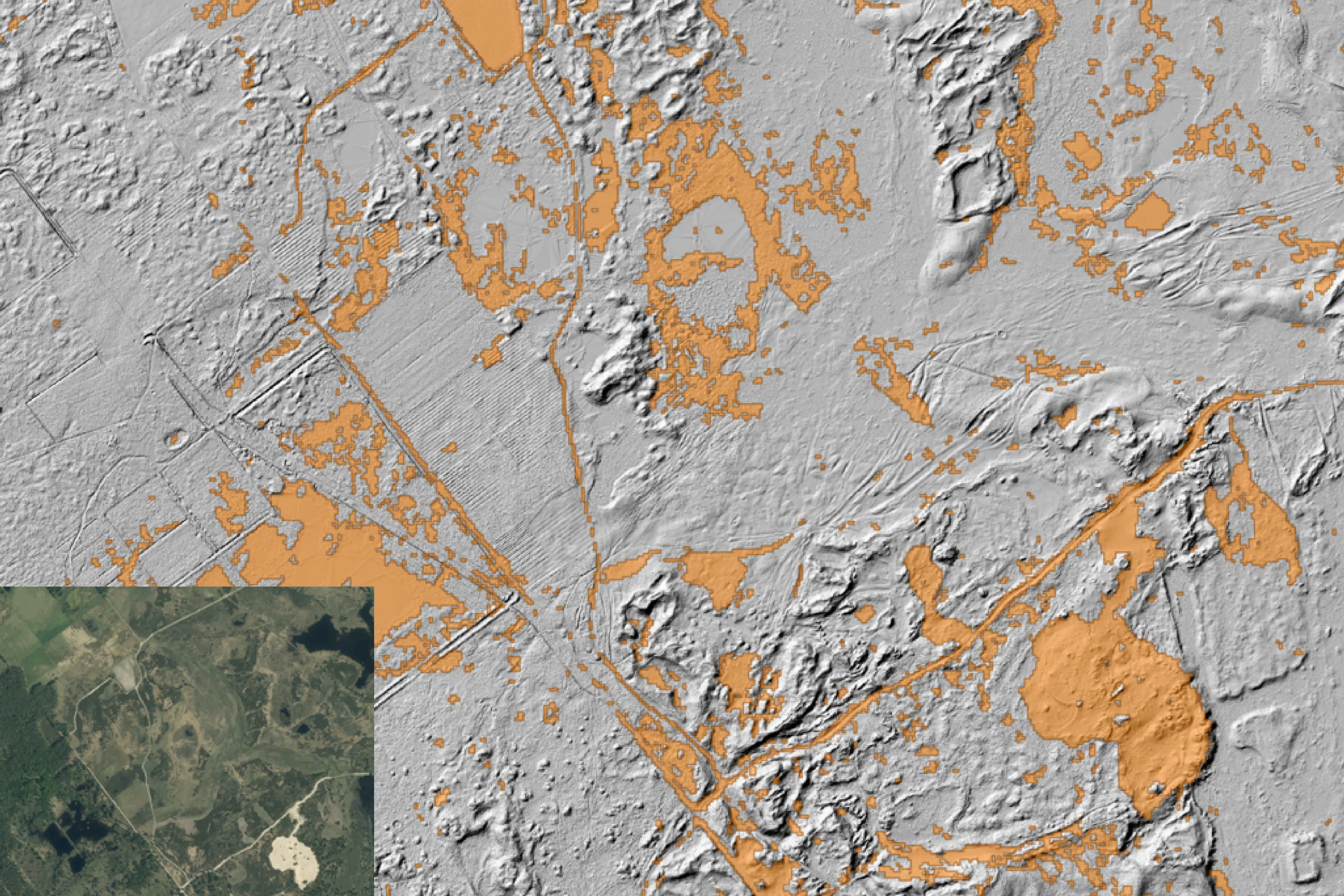
In Phase 2, we will further advance monitoring, forecasting, risk assessment, and decision-support capabilities to help authorities and stakeholders better understand environmental conditions, anticipate emerging climate risks, and make informed decisions.
About WI4EURECA
The WI4EURECA Consortium brings together expertise in Earth Observation (EO), hydrological modeling, civil engineering, agriculture, crisis management, and spatial data science.
The solution that the Consortium is working on is a modular, cloud-based decision-support system designed to support climate adaptation. The key features of the solution include:
- Physically-Based Modelling: To ensure consistent and scientifically sound outputs
- User-Centric Interface: An interactive dashboard to visualize, analyze, and compare key indicators (e.g., soil moisture, evapotranspiration, land surface temperature) for scenario analysis and climate risk assessment
- Multi-Scale and Multi-Content Capability: To generate time series for analyzing seasonal variables, extreme events, and spatial variability for both rural and urban use cases
At the core of WI4EURECA are advanced models that describe the Soil-Water-Vegetation system in a consistent and scalable way across Europe.
About PCP WISE
The PCP WISE is a Pre-commercial Procurement (PCP) action funded by the European Commission’s Horizon Europe Programme and selected under the call HORIZON-CL6-2024-GOVERNANCE-01-5. PCP WISE plays a key role in advancing the European Green Deal’s objectives by enhancing the use of Environmental Observation, data and products. The project has started in January 2025 and runs for 36 months.

 Cookie Policy