


Understanding the Basics of LiDAR Mapping

LiDAR mapping is transforming how we understand the world around us. This technology uses laser pulses to create detailed maps and images. It provides precise topographical data that is invaluable in many fields.
From archaeology to urban planning, LiDAR methodology reveals hidden features and structures. It penetrates vegetation, offering insights into forest floors and archaeological sites. The accuracy of LiDAR data makes it a reliable tool for detailed mapping.
As LiDAR technology advances, its applications continue to expand. It is now crucial for flood risk management and infrastructure development. Understanding LiDAR maps is essential for anyone interested in modern mapping technologies.
What is LiDAR Mapping?
LiDAR stands for Light Detection and Ranging. It is a remote sensing technology that uses laser light to measure distances. By emitting pulses of light, LiDAR captures the distance between objects and the sensor.
This method results in precise topographical details of the Earth’s surface. LiDAR mapping involves several components working together, including:
- A laser
- A scanner
- A specialized GPS receiver
Using these tools, LiDAR maps offer accurate, high-resolution 3D representations. This technology is mounted on aircraft or drones for comprehensive surface analysis.
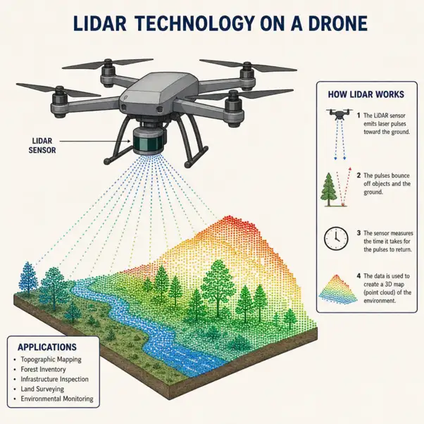
By timing how long it takes for laser pulses to return, LiDAR effectively captures elevation data. This capability has enabled breakthroughs in various scientific and practical applications.
How LiDAR Maps Are Created
Creating LiDAR maps involves several steps to ensure precision and detail. First, a laser emits light pulses towards the Earth's surface. The light bounces back to the sensor, measuring how long the round trip takes. The data is then processed to generate detailed images and maps. Key steps in this process include:
- Capturing raw data with sensors
- Processing data into point clouds
- Converting point clouds to 3D models
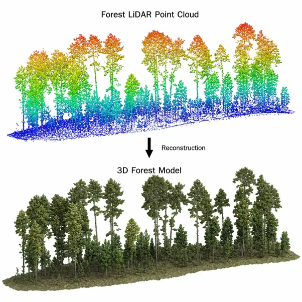
These steps combine to form high-resolution LiDAR based imagery. LiDAR data's accuracy makes it indispensable for detailed mapping tasks in diverse fields. This method provides insights that are invisible through traditional techniques.
Key Applications of LiDAR-Based Imagery and Data
LiDAR imagery finds utility across numerous fields and industries. The technology is pivotal in archaeology, where LiDAR can detect hidden ruins beneath forest canopies. It's also essential in forestry for assessing tree height and canopy density.
Environmental scientists use LiDAR to track changes in landscapes over time. Its applications stretch to urban planning and infrastructure, providing accurate terrain information. Key sectors benefiting from LiDAR include:
- Archaeology: Unearthing hidden sites
- Forestry: Monitoring forest health
- Urban Planning: Designing smart cities
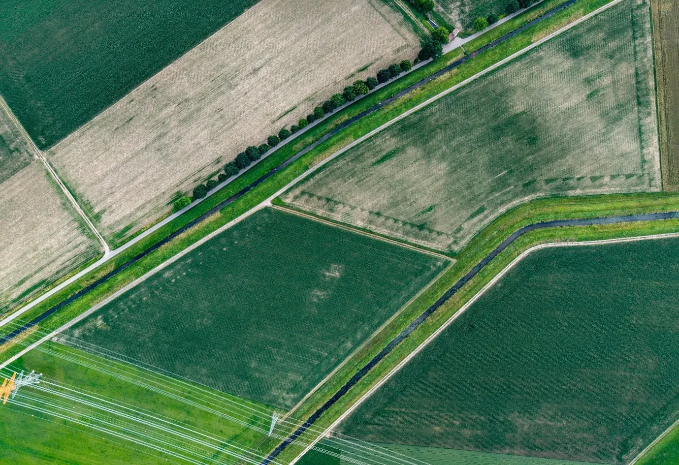
In flood risk management, LiDAR maps play a crucial role. The data supports creating detailed floodplain models.
Overall, LiDAR's precision aids in making informed decisions and understanding our environment better.
Using LiDAR in Forestry
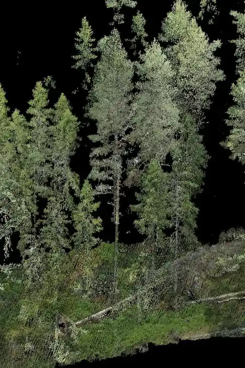
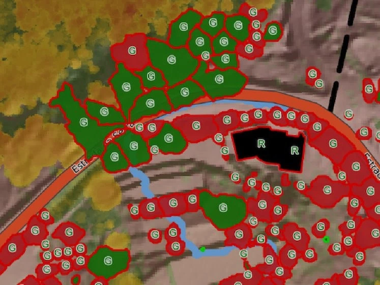
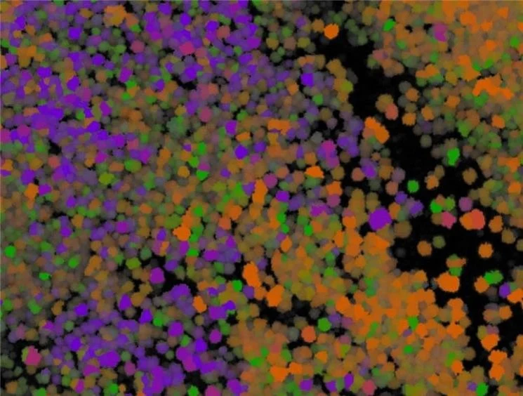
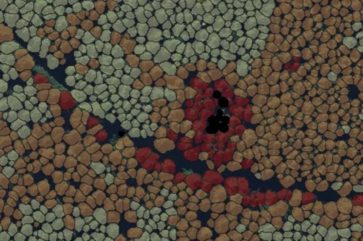
LiDAR technology is a game-changer for forestry, providing precise topographical maps and detailed insights into forest structure. Its ability to penetrate dense canopies allows foresters to assess tree height, density, and overall biomass effectively.
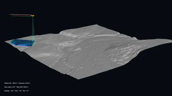
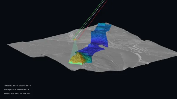
Below, the screen grabs from a video produced by Felix Morsdorf, demonstrates how the roll angle of an aircraft influences the ground coverage of an airborne LiDAR system and how individual laser returns are combined over time to create a detailed 3D point cloud. Like any educational visualization, its purpose is to illustrate the core concepts of LiDAR data acquisition and point cloud generation rather than replicate every technical or engineering detail of a real-world system.
“LiDAR technology has been utilized in the forestry sector in Finland for nearly two decades. Each year, approximately 3.5 to 4 million hectares of forest data are gathered using LiDAR methodology in Finland. LiDAR is capable of producing forest measurements with reduced bias from human error.” — Risto Rautiainen, Head of Remote Sensing Data Production at Arbonaut
Top 5 Uses of LiDAR in Forestry
- Precision Mapping: LiDAR produces accurate topographical maps, allowing foresters to analyze terrain features and identify variations in elevation. This precision is crucial for assessing slopes, valleys, and stream networks within forested areas.
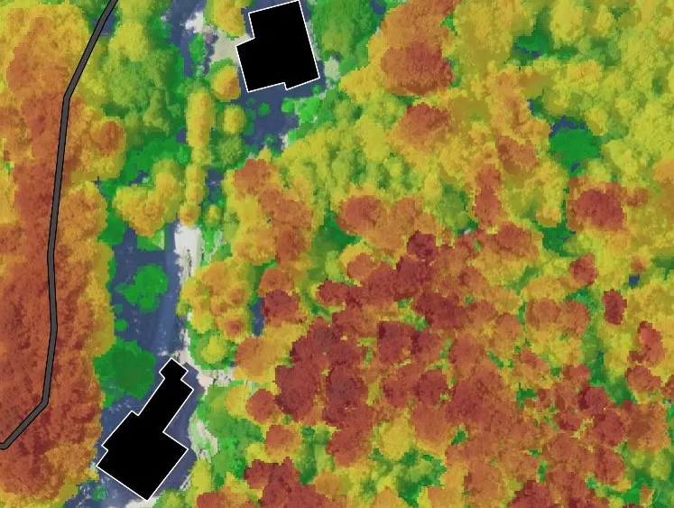
- Canopy Structure Analysis: One of the standout features of LiDAR is its capacity to visualize tree heights and density. By creating detailed three-dimensional models of forest canopies, foresters can estimate biomass, analyze canopy cover, and understand forest structure at a much deeper level.
- Change Detection: LiDAR is instrumental in monitoring changes in forest ecosystems over time. It enables professionals to compare historical data with current LiDAR maps, helping them track deforestation, reforestation, and the impacts of natural disasters on forest health.
- Wildlife Habitat Assessment: By understanding the structure of forests, wildlife managers can make informed decisions regarding habitat preservation and restoration. LiDAR data can identify suitable habitats for various species based on canopy coverage and vegetation structure.
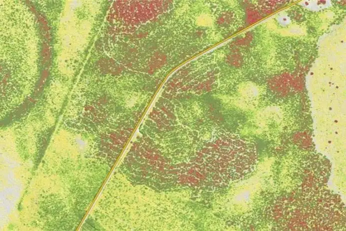
- Forest Health Monitoring: LiDAR assists in assessing tree health by measuring canopy volume and density. This data can signal potential issues, such as disease, pest infestations, or the effects of climate change, allowing for timely intervention.
The Value and Limitations of Using LiDAR in the Forestry Industry
LiDAR technology has emerged as a transformative tool in the forestry industry, offering unprecedented insights and capabilities that enhance forest management, conservation, and research efforts. By utilizing light detection and ranging, LiDAR enables foresters to gather accurate and high-resolution data about forest structure, health, and dynamics.
However, while the advantages are significant, it’s essential to recognize the limitations that come with LiDAR technology as well.
The Value of LiDAR in Forestry
- Precision and Accuracy: LiDAR has proven to be a highly accurate technology for forest measurement and inventory. Numerous studies have shown that LiDAR can estimate key forest attributes such as tree height, timber volume, and aboveground biomass with a high degree of precision.
For example, Levick et al. (2016) found that airborne LiDAR predicted forest wood volume with an R² value of 0.92, meaning it explained 92% of the variation in measured wood volume, demonstrating excellent agreement with field-based inventories.
Additionally, a systematic review and meta-analysis of 52 studies by Thapa et al. (2025) concluded that airborne LiDAR consistently delivers accurate biomass estimates across a wide range of forest types and has become one of the most reliable tools for large-scale forest monitoring and carbon assessment. These findings, supported by extensive research and operational use, demonstrate that LiDAR is a robust and dependable technology for modern forestry applications.
- Cost & Time Savings: Advances in LiDAR technology have reduced survey costs to the point where forestry organizations can realize both immediate and long-term savings. By rapidly collecting accurate forest inventory data over large areas, LiDAR reduces fieldwork requirements, labor costs, and inventory times while improving decision-making for harvest planning and forest management. These efficiencies continue to generate long-term value through repeated use of high-quality forest data.
- Scalability: LiDAR is highly scalable, making it well suited for forestry operations ranging from small private woodlands to national forest inventories. Unlike traditional field surveys, which rely on sampling a limited number of plots, LiDAR can rapidly collect detailed data across thousands or even millions of hectares, providing consistent and comprehensive forest information. This scalability allows forestry organizations to efficiently monitor timber resources, biomass, forest health, and carbon stocks over large areas while maintaining high levels of accuracy. The widespread adoption of LiDAR in national forestry programs further demonstrates its ability to support large-scale forest management and planning.
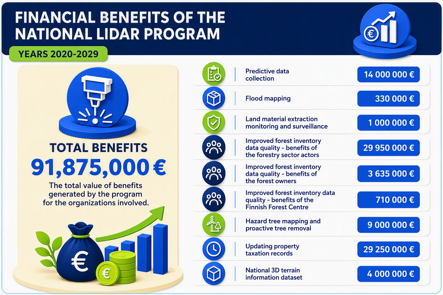
This assessment was calculated in 2019 by the National Land Survey of Finland before the national LiDAR program began. The National LiDAR Program is projected to generate €91.9 million in benefits between 2020 and 2029, demonstrating the significant economic value of LiDAR. The largest benefits come from improved forest inventory data quality (€34.3 million combined) and updating property taxation records (€29.3 million), highlighting LiDAR's ability to improve decision-making, resource management, and operational efficiency.
Limitations of LiDAR in Forestry
- High Initial Costs: The cost of acquiring LiDAR technology and conducting surveys can be a barrier, particularly for smaller forestry operations or organizations with limited budgets. While technology costs are decreasing, the initial investment may still be prohibitive for some.
- Data Processing Challenges: LiDAR data requires specialized software and expertise for processing and interpreting, which may not be readily available to all forestry practitioners. The complexity of managing large datasets can also be a barrier to efficient use.
- Digitalizing forest value chains with reliable solutions
- Creating web, desktop and native mobile applications
- Combining Arbonaut’s forestry expertise with ICT capabilities
- Cost-efficient ready-made products, customized solutions for unique needs, and custom APIs
- Possibility to build add-ons on top of commercial and open-source GIS software
- Signal Interference: Dense vegetation and complex forest structures can interfere with the laser signals used in LiDAR, potentially leading to gaps in the data. This can limit the effectiveness of LiDAR in certain environments and require careful planning to mitigate issues.
- Limited Penetration in Some Conditions: While LiDAR can penetrate vegetation, certain dense canopies may still pose challenges. In cases where forest canopies are excessively thick, obtaining accurate data on ground-level features may be difficult.
Our solution: At Arbonaut, we provide a comprehensive cost versus value analysis that illustrates how investing in LiDAR technology yields substantial long-term benefits for forestry operations. By emphasizing the potential return on investment through enhanced efficiency, improved data accuracy, and better decision-making, we help organizations recognize the lasting savings and value that LiDAR can bring to their forestry management practices.
Our solution: Fortunately, our team is well-prepared to tackle these challenges and utilizes their expertise with the necessary software. Different formats based on the customer wants and needs are selected whether it be:
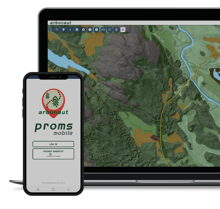
For example, Arbonaut has developed ProMS, a flexible GIS solution that enables organizations to quickly deploy mapping and data management workflows, integrate spatial data from multiple sources, collaborate easily with stakeholders, and access information through web and offline mobile applications. The platform also supports custom system integrations and is trusted by more than 30 organizations and 500 users worldwide.
Our solution:
-Optimal Flight Planning: We work with a wide network of LiDAR data collection partners that utilize advanced flight planning algorithms to identify the best times and altitudes for LiDAR data collection, effectively minimizing signal interference.
-Multi-Sensor Fusion: By combining LiDAR with other remote sensing technologies, such as aerial photography or satellite imagery, we can address gaps caused by signal interference. At Arbonaut, we strive to implement the most suitable approaches tailored to each customer's unique needs.
Our solution:
-Adjusting LiDAR Settings: By using different wavelengths of laser light, our wide network of LiDAR data collection partners can enhance penetration capabilities in dense environments.
-Supplementary Data Collection: Implementing ground-based surveys or complementary methods allows us to gather additional ground-level data in areas where LiDAR may face challenges. Our wide network of LiDAR data collection partners carefully selects the most effective methods for each specific environment.
The Future of LiDAR Mapping
"As LiDAR scanners become more affordable and efficient each year, the volume of collected LiDAR data will continue to grow. In the future, we will gain increasingly accurate insights into our forests." — Risto Rautiainen, Head of Remote Sensing Data Production at Arbonaut
The future of LiDAR mapping looks promising with ongoing technological advances. As costs decrease and precision increases, LiDAR will become more accessible and integral to varied industries.
Also, integration with other technologies, like autonomous vehicles and smart cities, will further expand LiDAR's potential. Its role in environmental monitoring and urban planning will only grow with time.
Key Takeaways
- LiDAR mapping technology uses laser scanning to generate highly accurate 3D terrain models, digital elevation models and topographic maps.
- In the forestry industry, LiDAR supports forest inventory management, timber resource assessment, carbon monitoring, and sustainable forest management.
- LiDAR accurately measures tree height, canopy cover, forest biomass, and forest structure, even in densely vegetated areas.
- Common forestry applications include forest health monitoring, wildfire risk assessment, deforestation tracking, reforestation planning, and biodiversity mapping.
- Research has shown that airborne LiDAR can achieve forest volume estimation accuracies as high as R² = 0.92, making it a reliable tool for forest inventory and resource planning.
- LiDAR reduces the need for extensive field surveys, helping organizations lower forest inventory costs, improve operational efficiency, and accelerate data collection.
- National programs, including those in Finland, demonstrate the value of large-scale LiDAR forest mapping for improving decision-making and resource management.
- LiDAR is highly scalable and can be deployed across private forests, commercial plantations, and national forest inventory programs.
- Key challenges include data processing requirements, dense canopy interference, and upfront survey costs, although advances in technology and Arbonaut’s expertise help to reduce these barriers.


 Cookie Policy