Development of the CEMIS Platform for the Ministry of Environment in Cambodia
Background
Protected areas cover 41 % of the Cambodia’s total land area. The Ministry of Environment is responsible for managing and supervising the country’s protected areas in cooperation with other institutions.
There is also the pressure on different types of use inside protected areas and achieving balance between biodiversity conservation, livelihoods, and human wellbeing.
To strengthen environmental governance and improve decision-making across Cambodia’s protected areas, the Ministry of Environment in Cambodia assigned Arbonaut to develop an integrated Information System and Decision Support System.
Solution
CEMIS (Cambodia Environmental Management Information System) is a component under the Cambodia Sustainable Landscape and Ecotourism Project (CSLEP) financed by the World Bank.
Overall purpose of the CEMIS is to strengthen the capacity for Protected Area (PA) planning and management and law enforcement in the Ministry of Environment and Department of GIS (DGIS).
Arbonaut was given specific objectives in the project:
- Develop user-friendly open source Platform and Portal for integrating data in order to display and analyze the datasets needed for Protected Areas management in one central database
- Share the data sets to all relevant departments and stakeholders who need the data in Protected Areas management
- Support integration of existing Decision Support Systems (DSS) into CEMIS
- Develop decision support and analysis tool (ISDS) for Protected Areas management based on the integrated data, especially for zoning
- Provide training on the CEMIS tools, data management and integration
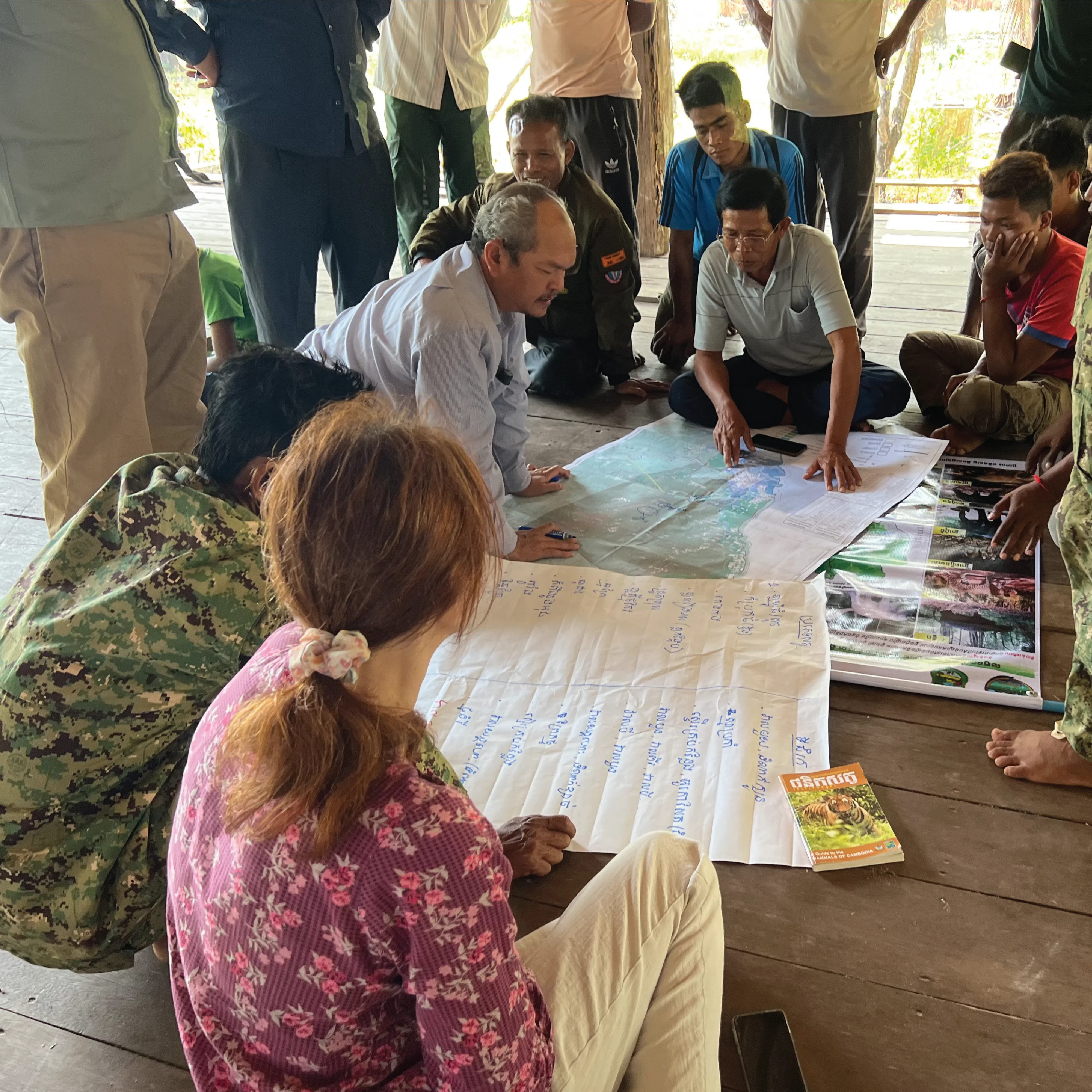
Fieldtrip to Koh Kong province, Cambodia
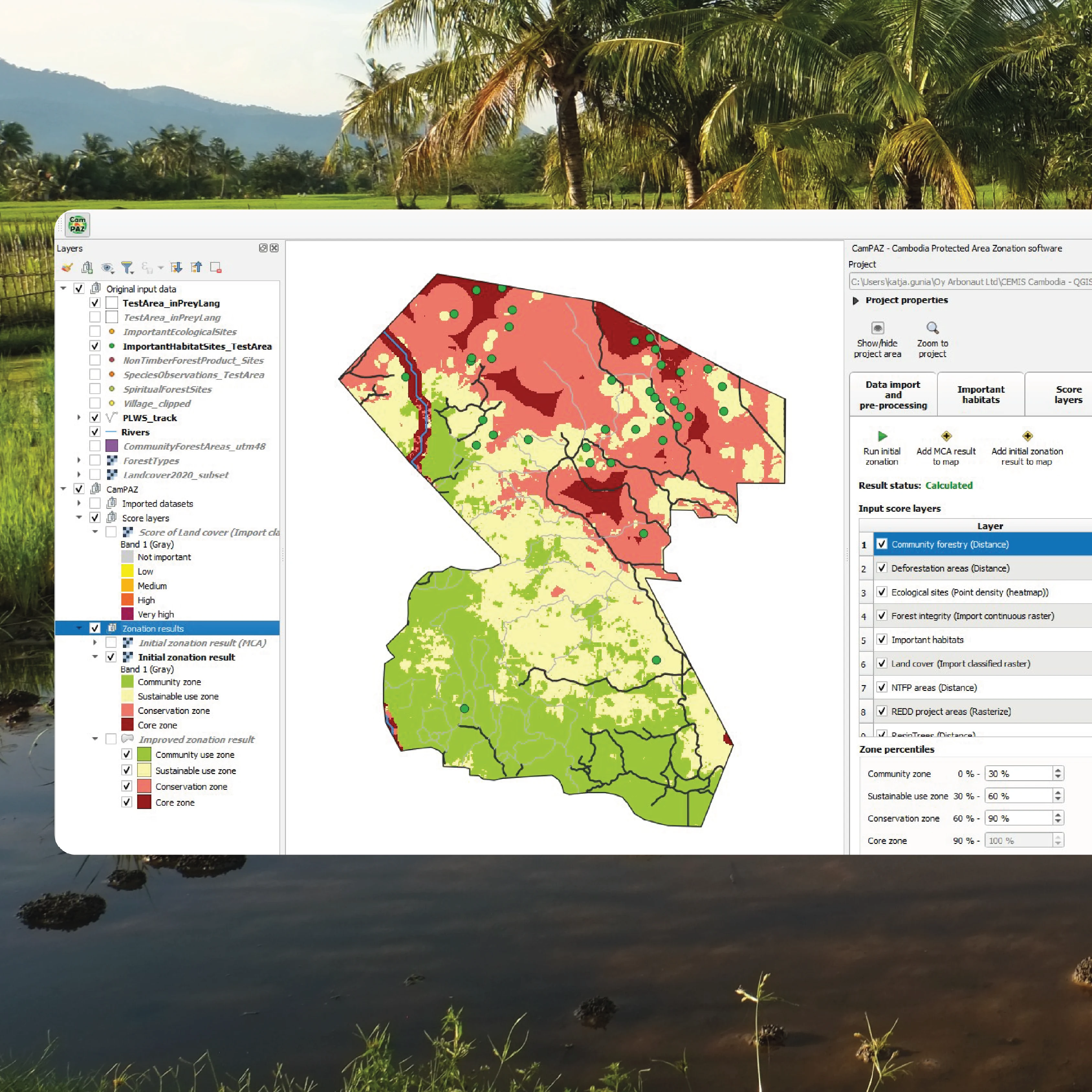
CEMIS platform
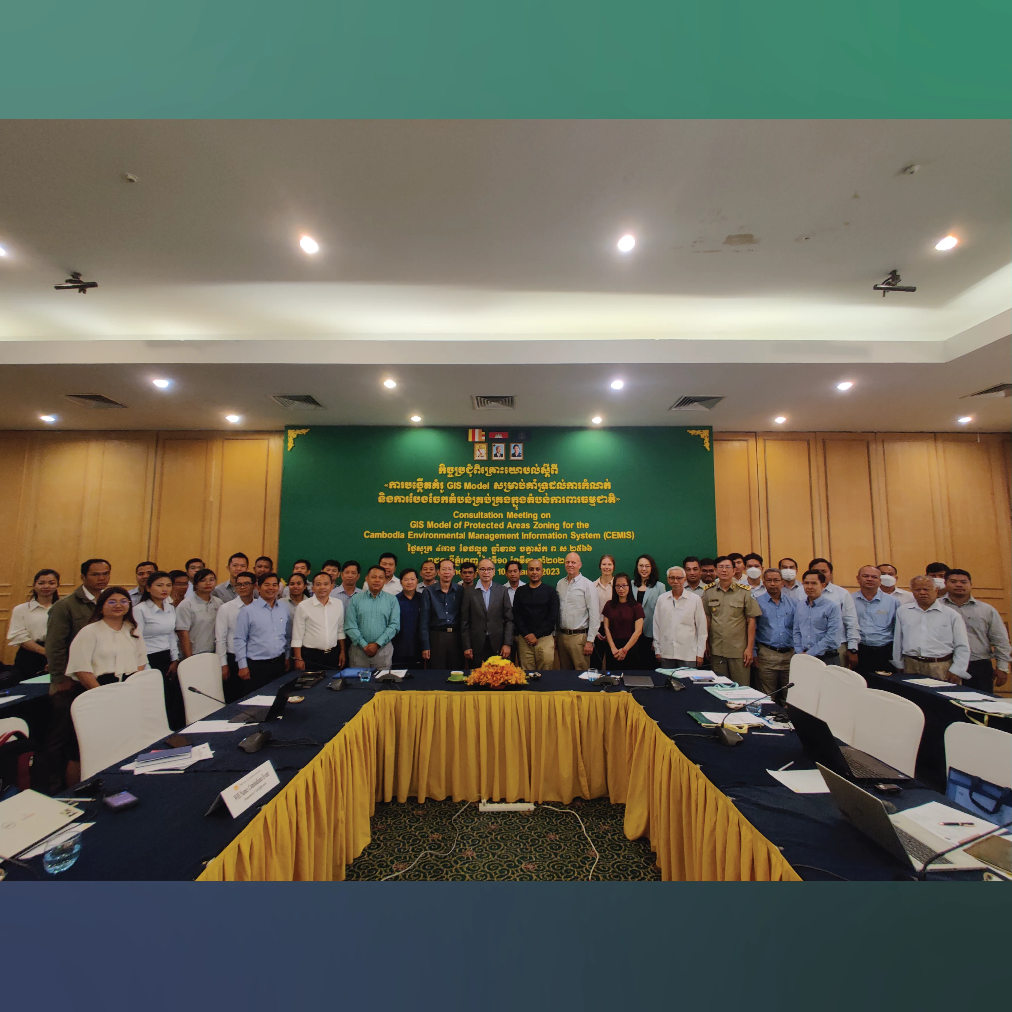
Consultation meeting with the Ministry of Environment
CEMIS has 2 main modules:
- CEMIS Portal
- CEMIS Information Spatial Decision Support system (ISDS) to help evaluate development and conservation priorities
Built as a QGIS-based solution, the ISDS provides zoning recommendations across all protected landscapes covered by the project: core, conservation, sustainable use, and community areas.
It also supports land-allocation decisions for broader environmental-management needs.
Outcomes
Arbonaut worked with the DGIS to consolidate spatial and non-spatial datasets from national and international stakeholders into one central, open‑source platform.
With improved data integration, analysis, mapping, and visualization, CEMIS helps authorities:
- Monitor protected-area conditions
- Assess emerging threats
- Strengthen long-term conservation planning
Through extensive hands-on training and practical implementation support, the project enhanced DGIS’s technical capabilities and created a strong foundation for more coordinated, transparent, and effective environmental management across Cambodia’s protected areas.
The CEMIS now supports the Ministry of Environment and DGIS with accurate, timely, and data-driven management, from planning and implementation to monitoring and law-enforcement tasks.
 Cookie Policy