New Map Layers in ArboAqua Improve Water Catchment Analysis
Arbonaut has updated ArboAqua, its water catchment area analysis tool, with new map layers that broaden the environmental data available for planning and analysis.
Catchment analysis plays a key role in understanding how land use, soil conditions, and water systems interact within a defined area. Access to reliable geospatial data allows organizations to assess environmental risks, identify suitable project sites, and support planning processes more effectively.
Developed in response to customer feedback, the latest update introduces additional datasets that expand how users analyze and interpret catchment areas.
New Map Layers Now Available
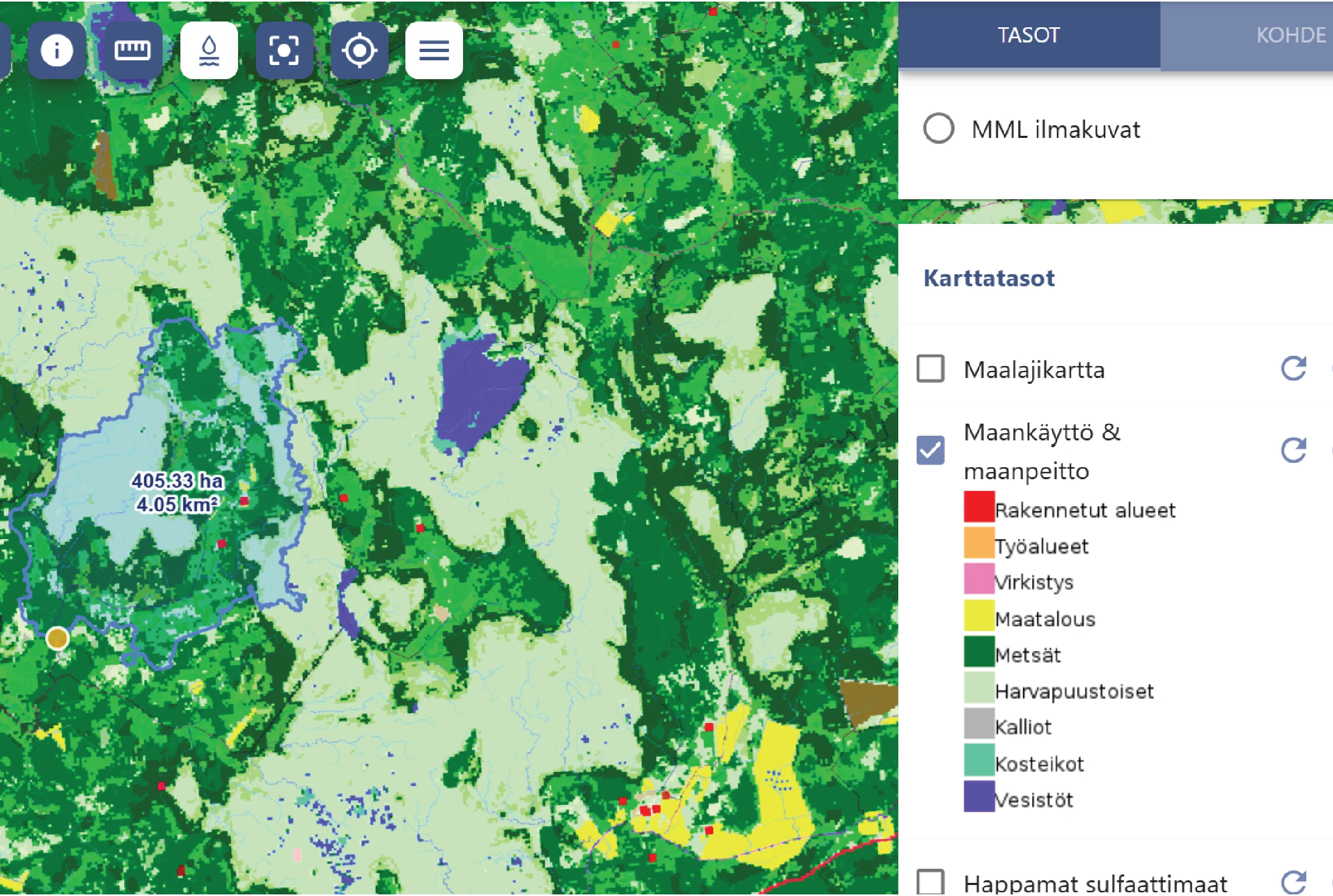
The new layers provide a broader environmental context, allowing users to access key geospatial information such as acid sulfate soils and SYKE catchment area boundaries within a single service.
The update includes:
- Land use and land cover (Maankäyttö ja maanpeite)
- Acid sulfate soils (Happamat sulfaattimaat)
- Groundwater areas (Pohjavesialueet)
- Catchment area divisions (Valuma-aluejako)
Together, these datasets give a more complete overview of conditions within a catchment area and support informed analysis across different project types. They can also be used to complement documentation required in environmental assessments and funding applications.
About ArboAqua
ArboAqua is a tool for catchment area analysis. The solution is designed to support planning, assessment, and decision-making in projects where catchment-level understanding is required.
ArboAqua is available as a browser-based service, allowing users to combine and review multiple data layers without the need for separate tools or data sources.
ArboAqua continues to evolve as part of Arbonaut’s broader geospatial offering for environmental planning and water-related projects. Updates are guided by user feedback and evolving data availability.
A free trial is available for users interested in exploring the new datasets.
 Cookie Policy