Preparing Entire Finland for Future Wildfires
Challenge
Finland’s summers are getting hotter and drier, increasing the chance of forest and grassland ignitions. Even countries with strong emergency infrastructures are seeing wildfire behavior become harder to predict and contain.
While Finland is comparatively well positioned, annual wildfires still pose risks to communities, ecosystems, and the economy. One of Finland’s great advantages, however, is the strength of its national forest information. With the right analytics, this data can support proactive, cost-efficient wildfire preparedness.
This idea became the foundation of the MARISKA project.
A national collaboration to strengthen wildfire resilience
MARISKA was a joint R&D effort between Finnish Forest Centre, Arbonaut, and Emergency Services Academy of Finland. The work formed part of the Ministry’s Carbon-Caught climate initiative launched in 2020.
The goal was to transform Finland’s existing forest data into actionable wildfire intelligence for rescue authorities nationwide.
From forest information to wildfire insight
Arbonaut developed nationwide static wildfire-risk maps by combining:
- Forest fuel data
- Vegetation structure
- Environmental variables
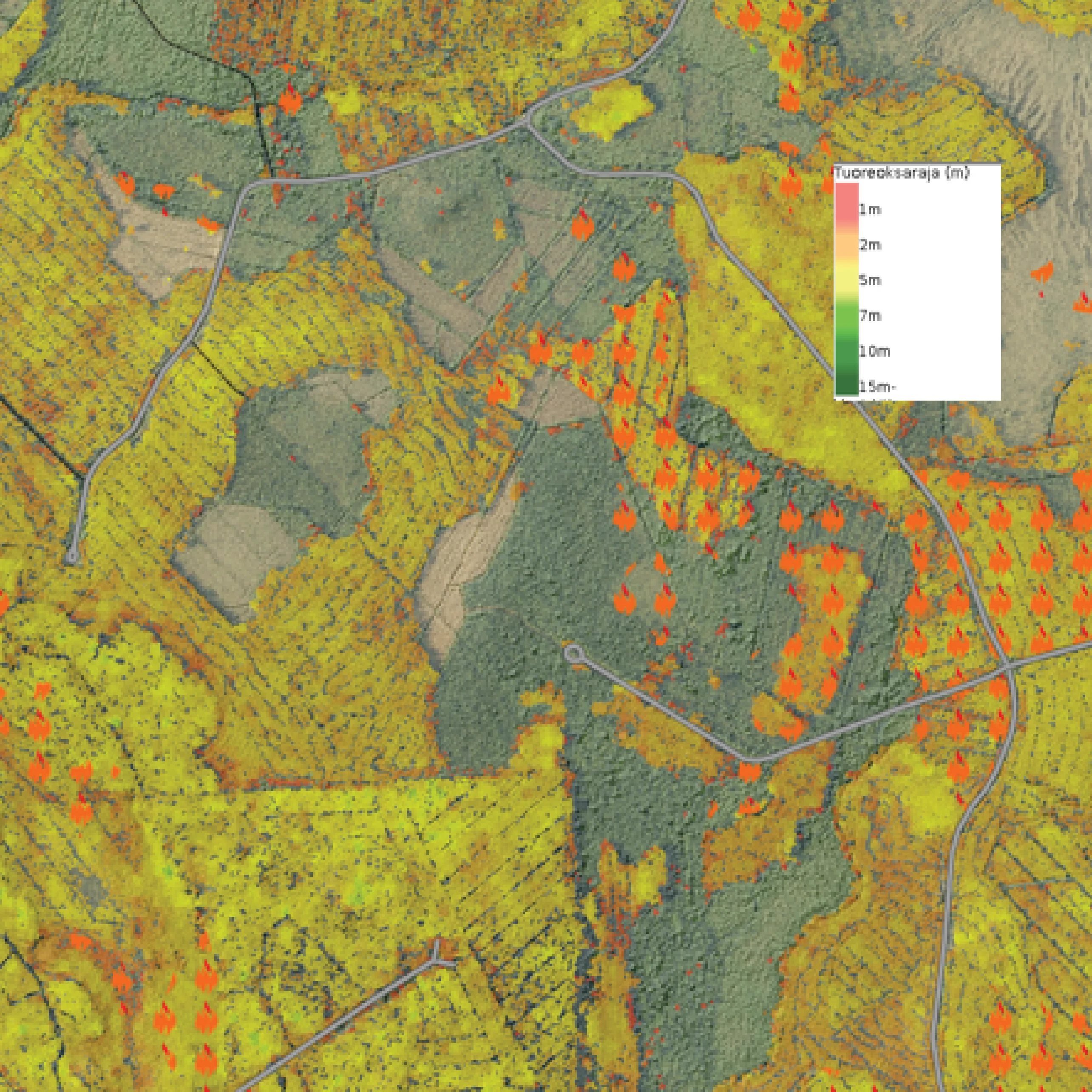
Canopy Base Height (CBH)
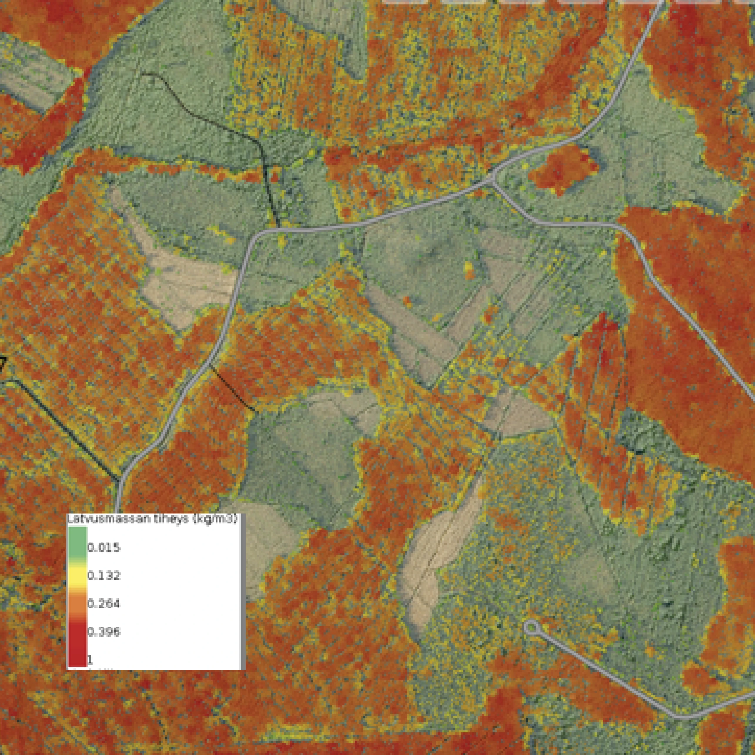
Canopy Bulk Density (CBD)
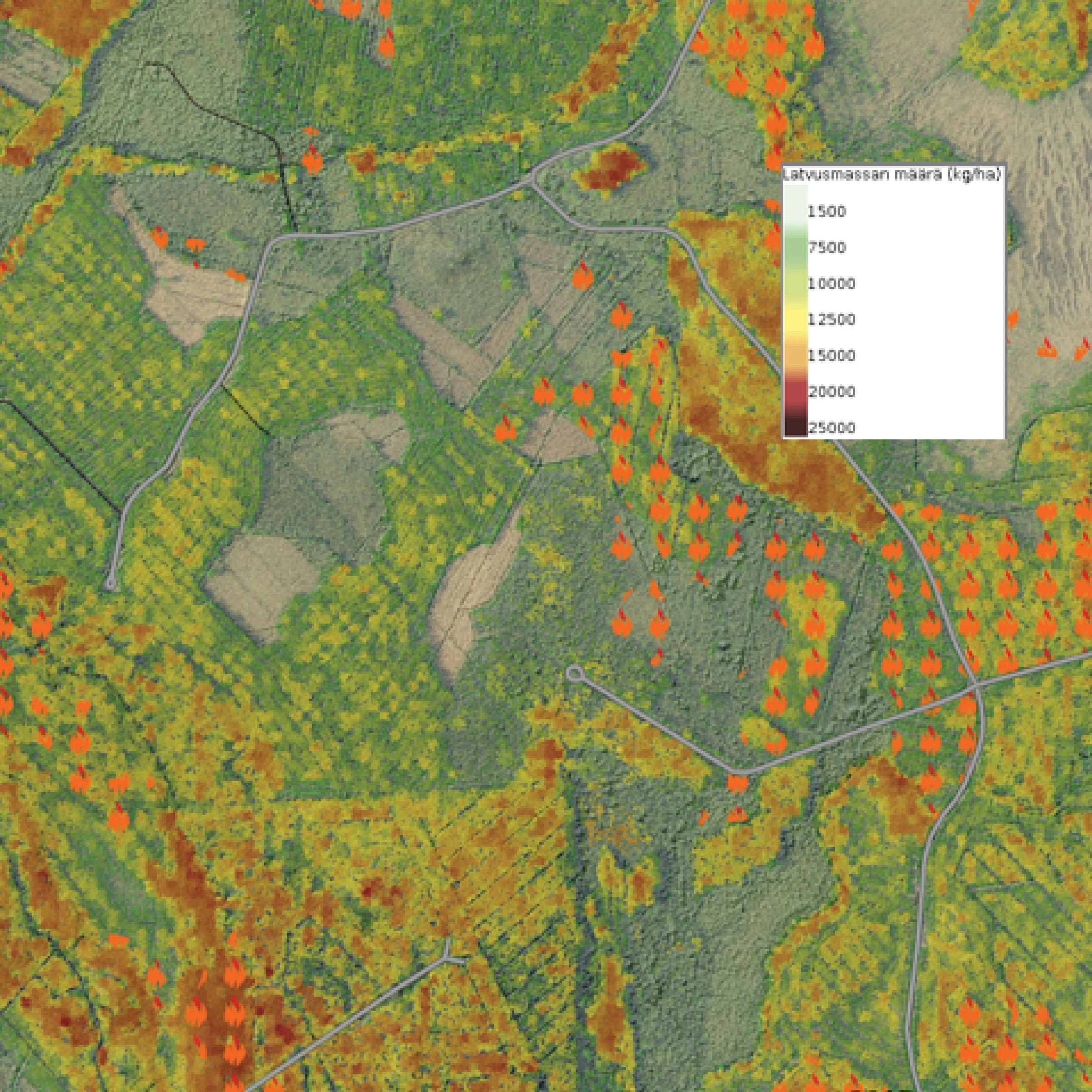
Canopy Fuel Weight (CFW)
These inputs helped identify areas where wildfire ignition and spread were most likely, giving authorities a comprehensive view of forest fire dynamics before emergencies occur.
Rescue departments tested the maps across browser, mobile, and tablet devices, ensuring usability directly in the field, including:
- Smarter planning with less field visits
- Better situational awareness during incidents
- Advance knowledge of target areas for safer, more efficient operations
- Improved firefighter safety through enhanced awareness
With intuitive tools and full national coverage, rescue authorities now have a proactive way to anticipate risk areas before fires escalate into emergencies.
Video testimonialFunded by the Ministry of Agriculture and Forestry. The project was part of the Carbon-Caught climate measure of the land use sector launched by the Ministry of Agriculture and Forestry in spring 2020.
 Cookie Policy