Real-Time Deforestation Monitoring Platform for Uganda
Challenge
Between 1990 and 2015, natural forest cover in Uganda reduced from 30% to 10% of total land area. Uganda has one of the highest deforestation rates and one of the fastest population growth rates globally. The UNDP Uganda Accelerator Lab recognized the need to halt deforestation and aimed to:
- Harness technology and mine real-time and innovative data on current state of deforestation, forest cover loss and afforestation efforts in place
- Develop a data sharing platform and harmonize datasets that can be accessible to government, private sector and other players on the trend of deforestation and forest cover loss and facilitate decision making
- Generate and forecast future trends and predict occurrences on forests to garner support for prevention and mitigation
Solution and outcomes
To support more responsive and data-driven forest management in Uganda, the project set out to design an experimental real-time data-visualization platform capable of tracking current deforestation trends in selected forest regions.
The initiative focused on three main objectives:
- Generate up-to-date insights on deforestation, forest-cover loss, and ongoing restoration using satellite technology.
- Create a user-friendly data-sharing platform that harmonizes multiple datasets and offers government agencies, private-sector actors, and civil-society partners a unified view of forest trends.
- Forecast future risks and identify emerging hotspots to help mobilize early interventions.
Two forest regions experiencing high levels of deforestation were selected as pilot sites, serving as testing grounds for real-time data processing workflows
Using Sentinel-1 radar and Sentinel-2 multispectral imagery, Arbonaut produced updated datasets that revealed recent forest-cover loss patterns.
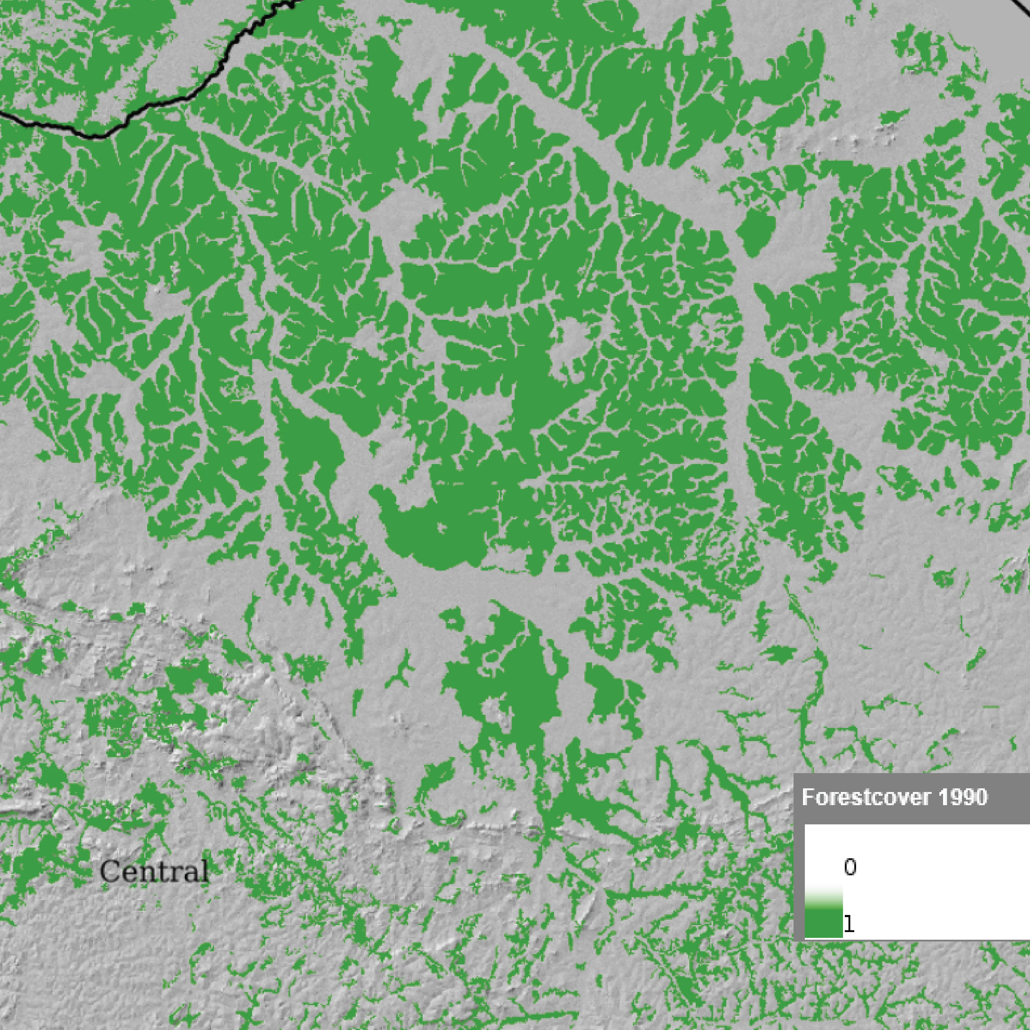
Forest cover in 1990
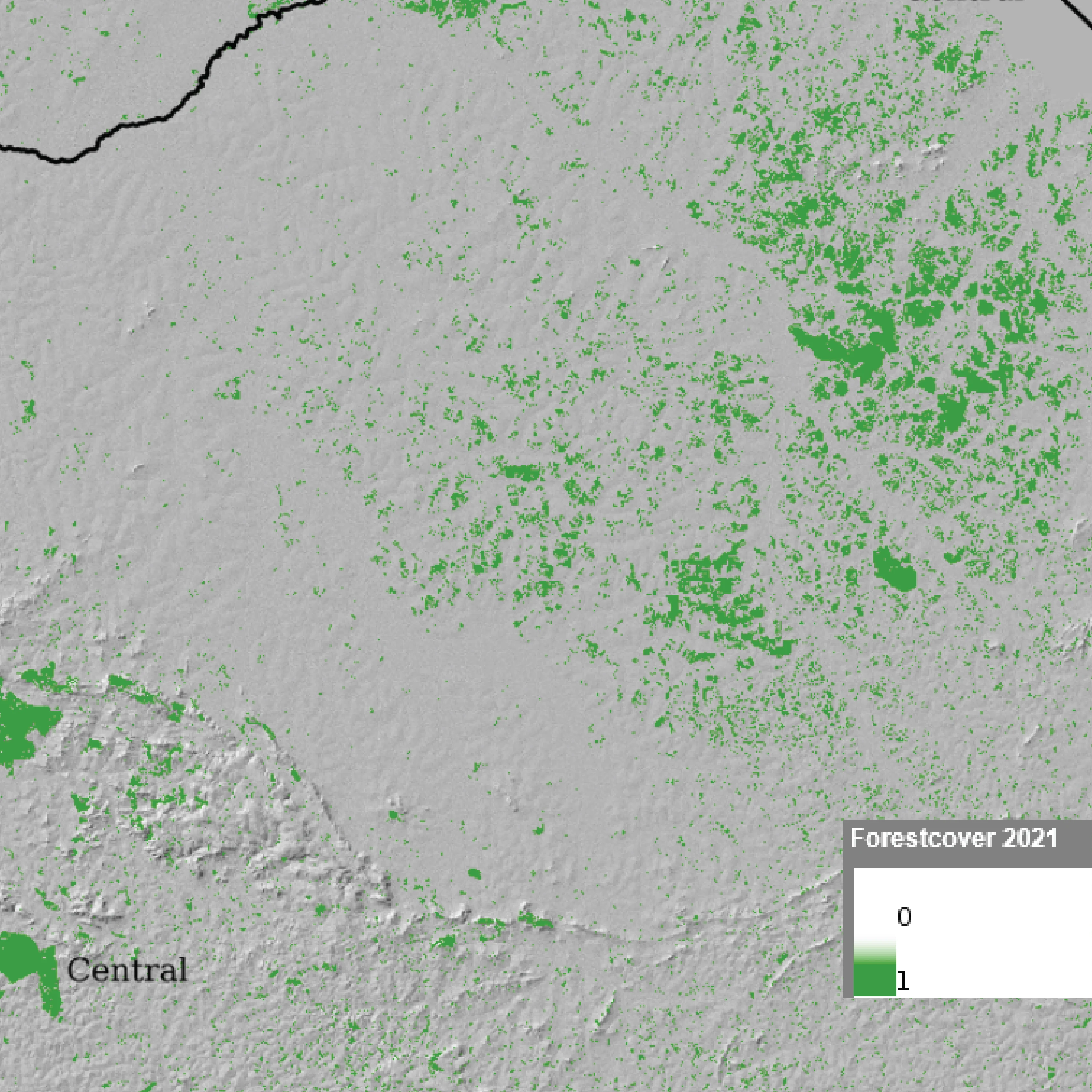
Forest cover in 2021
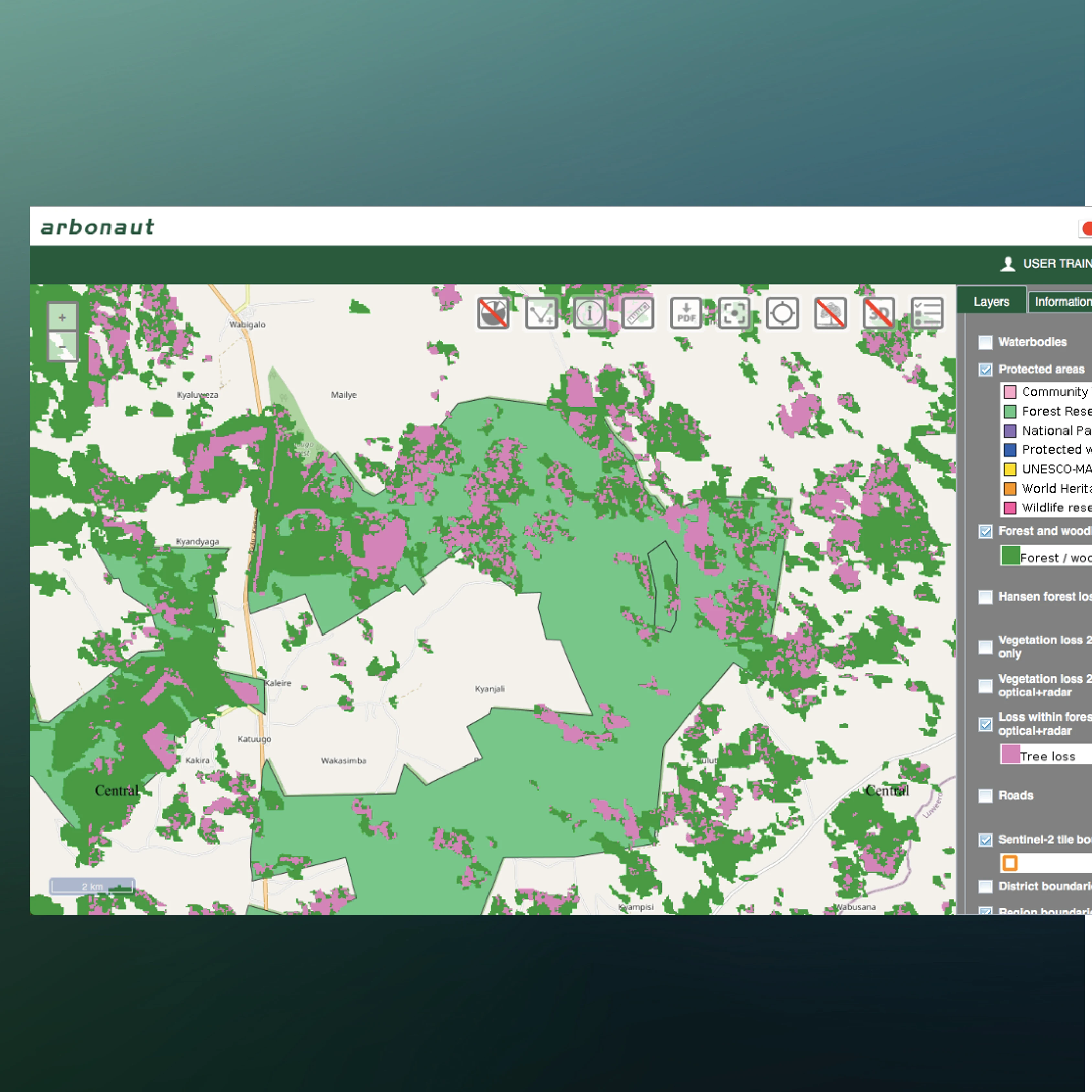
'NARIS' data-sharing platform
Google Earth Engine was used as a processing environment for handling and analyzing satellite data efficiently.
The platform itself was built on Arbonaut’s ProMS application, customized specifically for forest-monitoring needs
The work included:
- Compiling existing reference datasets
- Designing the data model and workflow processes
- Integrating new data sources
- Creating clear, intuitive visualization tools for decision-makers
In parallel with platform development, Arbonaut delivered comprehensive training and facilitated a full pilot phase with active user feedback. This ensured that both national and regional stakeholders could confidently use the system and understand its analytical outputs.
YouTube: Uganda Natural Resource Information System (NARIS) by UNDP Uganda Cookie Policy